Area Overview for SE10 8FF
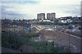
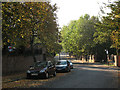
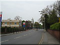
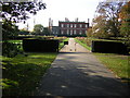
Photos of SE10 8FF


Area Information
SE10 8FF defines a specific postcode cluster within the broader Lewisham sector. This small residential footprint covers an area of just over 3,327 square metres. You will find 1,612 people currently calling this compact zone home. Living in SE10 8FF means navigating a tightly knit environment where every street corner brings you close to neighbours. The population density here registers at 484,518 people per square kilometre, creating a very concentrated living experience. This high density differentiates the postcode from larger, more sprawling districts in South East London. Daily life revolves around the immediate vicinity rather than long commutes down the road. The area functions as a distinct pocket within the wider urban landscape. You are part of a community defined by its small scale and intense proximity. Homes and residents share this limited physical space efficiently. The character of the neighbourhood is shaped by this compact boundary. It is an area where the local atmosphere is immediate and direct.
- Area Type
- Postcode
- Area Size
- 3327 m²
- Population
- 1612
- Population Density
- 6272 people/km²
The property market in SE10 8FF is characterised by a predominance of flats. This specific accommodation type suits the small 3,327 square metre area size perfectly. Only 35% of homes in the postcode are owned outright. This statistic indicates that a significant portion of the housing stock is rented. You should expect a local market divided between owner-occupiers and private landlords. The low ownership rate suggests tenants form the largest group of buyers or renters looking here. Properties are likely to be compact units designed for the high-density footprint. This housing profile appeals to those seeking urban living without buying a large house. The mix of ownership and tenancy creates a dynamic market. Buyers must navigate between purchasing a flat or investing in a leasehold property. The concentration of flats means limited ground floor options compared to suburbs. Understanding this split is essential for anyone considering homes in SE10 8FF. The data points to a rental-inclusive environment where competition exists for both freeholds and leases.
House Prices in SE10 8FF
Showing 72 properties
| Address | Type | Beds | Baths | Last Sale Price | Last Sale Date | |
|---|---|---|---|---|---|---|
| 4, Melville House, Sparta Street, London, SE10 8FF | undefined | - | - | - | - | |
| 11, Melville House, Sparta Street, London, SE10 8FF | undefined | - | - | - | - | |
| 35, Melville House, Sparta Street, London, SE10 8FF | undefined | - | - | - | - | |
| 15, Melville House, Sparta Street, London, SE10 8FF | undefined | - | - | - | - | |
| 19, Melville House, Sparta Street, London, SE10 8FF | undefined | - | - | - | - | |
| 29, Melville House, Sparta Street, London, SE10 8FF | undefined | - | - | - | - | |
| 33, Melville House, Sparta Street, London, SE10 8FF | undefined | - | - | - | - | |
| 34, Melville House, Sparta Street, London, SE10 8FF | undefined | - | - | - | - | |
| 38, Melville House, Sparta Street, London, SE10 8FF | undefined | - | - | - | - | |
| 37, Melville House, Sparta Street, London, SE10 8FF | undefined | - | - | - | - |
Energy Efficiency in SE10 8FF
You have access to a wide network of amenities just beyond the postcode boundary. Five metro stations serve the wider area, including Elverson Road, Deptford Bridge, and Cutty Sark for Maritime Greenwich. Retail options are equally plentiful with five notable convenience stores like Tesco Lewisham, Tesco Deptford, and Co-op London. Royal Greenwich manages several key rail hubs nearby, such as Greenwich Station and Lewisham Railway Station. Public transport waterside links include Greenwich Pier, Masthouse Terrace Pier, and Greenland Surrey Quays Pier. London City Airport sits within a short distance for business travellers. Three major coach stations provide further connections via green line services to London Victoria. This density of transport and retail means you rarely need to travel far for daily needs. The convenience of having Tesco and the mainline rail network close by shapes a self-sufficient lifestyle. Dining and shopping are immediate choices rather than distant plans.
Amenities
Schools
| Rank | School | Type | Entry gender | Ages |
|---|
Explore more schools in this area
Go to Schools tabDemographics
The community in SE10 8FF reflects a mature household profile. The median age recorded for residents is 47 years old. Most commonly, the population consists of adults between 30 and 64 years of age. This age range suggests the area attracts families or professionals in their middle years. Home ownership stands at 35% within the postcode. Consequently, the rental sector likely accommodates the remaining majority of the demographic. The predominant ethnic group is White, forming the largest segment of the local population. Accommodation types are primarily flats. This housing style aligns with the high-density nature of the 3,327 square metre footprint. You are dealing with a neighbourhood where long-term dwellers mix with tenants. The age distribution points to stability rather than a surge in new arrivals. The demographic data indicates a resident base settled into their current living arrangements. Understanding these figures helps you gauge the likely neighbours you might have.
Household Size
Accommodation Type
Tenure
Ethnic Group
Religion
Household Composition
Age
Household Deprivation
NS-SEC
Explore more demographic insights in this area
Go to Demographics tabPlanning
Planning Constraints
- Flood RiskPremium
- Ramsar Wetland SitesPremium
- Area of Outstanding Natural BeautyPremium
- Protected Nature ReservePremium
- Protected WoodlandPremium