Area Overview for SE10 8AG
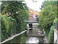
Photos of SE10 8AG


Area Information
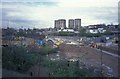
Living in SE10 8AG offers a distinct experience within a very compact residential cluster covering just 3584 square metres. You will find yourself in one of the most densely populated pockets in the country, with a population density reaching 449,731 people per square kilometre. This specific postcode covers 1612 residents and functions almost entirely as a residential hub where space is at a premium. The area is tightly packed, meaning daily life involves navigating a concentration of homes where neighbours are inevitably close by. This high density immediately shapes the rhythm of the neighbourhood, creating an environment where community interactions happen frequently but personal space is limited. For anyone considering homes in SE10 8AG, the reality is a built-up urban setting rather than a sprawling estate. The small geographical footprint means that everything from shops to transport links is often a short walk away, removing the need for a car in many instances. The character of the area is defined by its intensity and its location as a specific slice of Greenwich and Lewisham. You move quickly from street to street, blending into a community where every grid square holds significant population weight.
- Area Type
- Postcode
- Area Size
- 3584 m²
- Population
- 1612
- Population Density
- 6272 people/km²
The property market in SE10 8AG is characterised by a shortage of owner-occupiers and a heavy reliance on rental housing. With just 35% home ownership recorded in this postcode, the vast majority of residents are tenants securing accommodation in the private rental sector. The accommodation type data confirms that flats are the standard living arrangement for people living in SE10 8AG. This high percentage of flats is a direct response to the extreme land constraints, where 3584 square metres must house the entire community of 1612 people. If you are a buyer looking at homes in this area, you will primarily encounter flats that are likely let on long-term agreements. The small size of the residential cluster means there are no sprawling semi-detached homes or large detached estates to choose from. Instead, the housing stock is vertical and efficient, designed to maximise the use of limited urban space. For investors, the market suggests a strong demand for rental units from a population that struggles to buy due to high entry costs. The demographics show that while a smaller minority owns their home, the majority rents, indicating a dynamic market where leases turn over regularly and demand for premium flat living remains consistent.
House Prices in SE10 8AG
Showing 11 properties
| Address | Type | Beds | Baths | Last Sale Price | Last Sale Date | |
|---|---|---|---|---|---|---|
| 104 Blackheath Hill, London, SE10 8AG | Terraced | 4 | 2 | £937,000 | Aug 2025 | |
| 100 Blackheath Hill, London, SE10 8AG | Terraced | 4 | 2 | £650,000 | May 2023 | |
| 102 Blackheath Hill, London, SE10 8AG | Semi-detached | 3 | 2 | £700,000 | Dec 2020 | |
| 108 Blackheath Hill, London, SE10 8AG | house | - | - | £555,936 | Dec 2010 | |
| Flat D, 110 Blackheath Hill, London, SE10 8AG | Flat | 1 | 1 | - | - | |
| 98 Blackheath Hill, London, SE10 8AG | Terraced | 4 | 2 | - | - | |
| Flat A, 110 Blackheath Hill, London, SE10 8AG | Flat | 3 | 2 | - | - | |
| 106 Blackheath Hill, London, SE10 8AG | Terraced | - | - | - | - | |
| Flat C, 110 Blackheath Hill, London, SE10 8AG | Flat | - | - | - | - | |
| Flat E, 110 Blackheath Hill, London, SE10 8AG | Flat | - | - | - | - |
Energy Efficiency in SE10 8AG
Daily life in SE10 8AG benefits from an immediate array of transport, retail, and leisure options that are put within practical reach. You can walk to major rail hubs including Greenwich Station, Lewisham Railway Station, and St Johns, which provide rapid connections across London. For those who prefer water-based commutes, several ferry terminals such as Greenwich Pier, Masthouse Terrace Pier, and Greenland Surrey Quays Pier offer scenic routes to other parts of the capital. Grocery shopping is equally convenient with superstores like Tesco Lewisham, Sainsburys Greenwich, and Tesco Deptford located nearby for all your household needs. The area also boasts strong metro links with stations at Elverson Road, Deptford Bridge, and Cutty Sark for Maritime Greenwich. If you travel frequently by road, London City Airport is available within reach, alongside major coach stations including Green Line Coach Station and London Victoria Coach Station Arrivals. This density of amenities means you rarely need a car for daily tasks. Whether you want to grab a coffee before heading to work or explore the markets further afield, the infrastructure surrounding SE10 8AG supports a lifestyle that is active, convenient, and well-connected to the rest of the city.
Amenities
Schools
| Rank | School | Type | Entry gender | Ages |
|---|
Explore more schools in this area
Go to Schools tabDemographics
The community in SE10 8AG is defined by a mature resident base with a median age of 47 years. Adults between the ages of 30 and 64 years make up the most common age range, suggesting a population that values stability and established routines. Only 35% of residents own their homes outright, which indicates that a significant portion of the population relies on the private rental sector. The prevailing accommodation type is flats, aligning with the high-density nature of the postcode and the needs of the resident demographic. When you look at the breakdown of household types and ownership, it becomes clear that this is a market dominated by renters living in shared blocks or purpose-built apartments. The predominant ethnic group is White, but the area's small size ensures a close-knit social fabric where local knowledge travels quickly. With nearly 65% of residents not owning their property, there are likely fewer long-term family roots compared to homeowner-heavy estates. This demographic profile means you are likely dealing with a group of professionals or retirees who have chosen this specific location for its immediate access to employment and amenities rather than traditional garden-home suburbia.
Household Size
Accommodation Type
Tenure
Ethnic Group
Religion
Household Composition
Age
Household Deprivation
NS-SEC
Explore more demographic insights in this area
Go to Demographics tabPlanning
Planning Constraints
- Flood RiskPremium
- Ramsar Wetland SitesPremium
- Area of Outstanding Natural BeautyPremium
- Protected Nature ReservePremium
- Protected WoodlandPremium