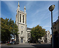
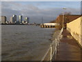
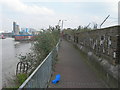
Area Overview for SE10 0YS
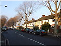
Photos of SE10 0YS

Area Information
The postcode SE10 0YS defines a specific residential cluster situated within London, England Spans just over 1000 square metres, this small district accommodates a population of 1643 residents. The community is characterised by a high concentration of people, reflecting a compact living environment where daily journeys often require purposeful movement. Living here means residing in a tightly knit post code sector that functions as a residential focal point rather than a sprawling suburban estate. You will find yourself in a defined zone where the immediate surroundings are built for efficiency and proximity to central services. The area represents a microcosm of London's urban density, offering a distinct lived experience that prioritises access over expansive outdoor space. Residents navigate a space where every purchase of property brings them into direct contact with the broader Greenwich landscape surrounding this small postcode area. Understanding the layout of SE10 0YS is essential for anyone considering homes in this specific location, as the sheer size dictates a lifestyle focused on integration with neighbouring districts and major transport nodes.
- Area Type
- Postcode
- Area Size
- 1009 m²
- Population
- 1643
- Population Density
- 32794 people/km²
The housing landscape of SE10 0YS is defined by a specific mix of tenures and building types that shape the local property market. Flats constitute the primary accommodation type, reflecting the urban reality of the small postcode area which covers merely 1009 square metres. With home ownership recorded at 54 per cent, the market is split roughly evenly between owner-occupiers and private renters. This balance means you will encounter a steady stream of homeowners looking to maintain their properties alongside investors seeking rental yields. The prevalence of flats suggests a demand for low-maintenance living within a confined footprint. Buyers viewing homes in SE10 0YS should expect a high-rise or apartment-style environment rather than detached or semi-detached houses. The 54 per cent ownership rate indicates a balanced but dynamic market where prices are influenced by both buyer demand and rental vacancy rates. Prospective buyers must recognise that the scarcity of land within this small cluster likely pressures property values, making each flat a valuable asset in a prime London location.
House Prices in SE10 0YS
Showing 8 properties
Energy Efficiency in SE10 0YS
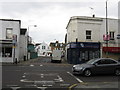
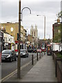
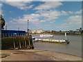
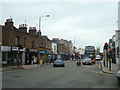
Living in SE10 0YS places you within practical reach of a diverse array of amenities that cater to shopping, travel, and leisure needs. Retail options include three notable locations such as Sainsburys Greenwich, Co-op Greenwich and Iceland Trafalgar, ensuring essential shopping is accessible nearby. Transport links are extensive, with five nearby rail stations including Maze Hill Railway Station, Westcombe Park, and Greenwich Station facilitating easy access to the wider network. Metro access is equally strong, with stations like Island Gardens, IFS Cloud Greenwich Peninsula, and North Greenwich enabling quick trips to cultural attractions. Ferry services operate from Greenwich Pier, North Greenwich Pier, and Royal Wharf Pier, offering scenic river crossings across London. London City Airport sits within one mile, providing convenient air travel for business or leisure. This density of facilities creates a lifestyle where daily tasks require minimal travel time. You can expect to find groceries, public transport, and airport access all clustered around your residence in this specific postcode area.
Amenities
Schools
| Rank | School | Type | Entry gender | Ages |
|---|
Explore more schools in this area
Go to Schools tabDemographics
The social fabric of SE10 0YS reflects a mature community where adults between the ages of 30 and 64 years form the most common age range. The median age of 47 indicates a neighbourhood populated largely by individuals and families in their middle years rather than young professionals or retirees. Home ownership stands at 54 per cent, suggesting that just over half the households have purchased their residences while the remainder are likely tenants. Accommodation type data confirms that flats dominate the housing stock, aligning with the high-density nature of the postcode's 1009 square metre footprint. The predominant ethnic group is White, providing a baseline for the area's demographic composition. With a population of 1643 in such a confined space of 1009 square metres, the living arrangement is inherently communal. This demographic profile points to a stable environment where residents have developed long-term ties to the locality. When considering schools near SE10 0YS, parents in this age bracket would be the primary demographic seeking family-friendly options. The concentration of adults in this three-decade age span creates a steady community where long-term residents often pass on local knowledge to newcomers.
Household Size
Accommodation Type
Tenure
Ethnic Group
Religion
Household Composition
Age
Household Deprivation
NS-SEC
Explore more demographic insights in this area
Go to Demographics tabPlanning
Planning Constraints
- Flood RiskPremium
- Ramsar Wetland SitesPremium
- Area of Outstanding Natural BeautyPremium
- Protected Nature ReservePremium
- Protected WoodlandPremium