Area Overview for SE10 0EG
Photos of SE10 0EG
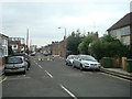
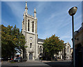
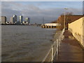
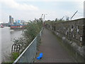
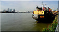
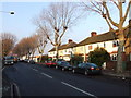
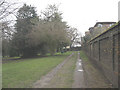
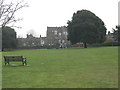
100 photos from this area
Area Information
Key information about the SE10 0EG including its size, population, and administrative classification.
- Area Type
- Postcode
- Area Size
- 5621 m²
- Population
- 1525
- Population Density
- 14160 people/km²
House Prices in SE10 0EG
54
Properties
£616,250
Average Sold Price
£199,950
Lowest Price
£872,300
Highest Price
Showing 54 properties
| Address | Type | Beds | Baths | Last Sale Price | Last Sale Date | |
|---|---|---|---|---|---|---|
| 49 Azof Street, Greenwich, SE10 0EG | Terraced | 3 | 1 | £735,000 | Jul 2025 | |
| 33 Azof Street, Greenwich, SE10 0EG | Flat | 1 | 1 | £420,000 | Jul 2025 | |
| 31 Azof Street, Greenwich, SE10 0EG | Flat | - | - | £360,000 | Apr 2025 | |
| 57 Azof Street, Greenwich, SE10 0EG | house | 3 | 2 | £810,000 | Mar 2025 | |
| 53 Azof Street, Greenwich, SE10 0EG | Flat | - | - | £543,000 | Sep 2024 | |
| 7 Azof Street, Greenwich, SE10 0EG | Terraced | 3 | 1 | £850,000 | Jan 2024 | |
| 17 Azof Street, Greenwich, SE10 0EG | Terraced | 3 | 1 | £872,300 | Mar 2023 | |
| 37 Azof Street, Greenwich, SE10 0EG | Terraced | 3 | 2 | £820,000 | Jun 2022 | |
| 39 Azof Street, Greenwich, SE10 0EG | Terraced | 3 | - | £795,000 | Dec 2020 | |
| 47 Azof Street, Greenwich, SE10 0EG | house | - | - | £770,000 | Feb 2020 |
Page 1 of 6
Energy Efficiency in SE10 0EG
Amenities
Schools
| Rank | School | Type | Entry gender | Ages |
|---|
Explore more schools in this area
Go to Schools tabDemographics
Household Size
Two person
most common
Accommodation Type
Flats
most common
Tenure
53
majority
Ethnic Group
White
most common
Religion
N/A
most common
Household Composition
N/A
most common
Age
47
median
Adults (30-64 years)
most common
Household Deprivation
N/A
with no deprivation
NS-SEC
62
in Lower managerial occupations
Explore more demographic insights in this area
Go to Demographics tabPlanning
Planning Constraints
- Flood RiskPremium
- Ramsar Wetland SitesPremium
- Area of Outstanding Natural BeautyPremium
- Protected Nature ReservePremium
- Protected WoodlandPremium