Area Overview for RM9 4SD
Photos of RM9 4SD
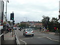
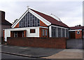
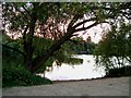
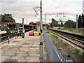
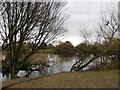
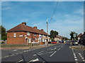
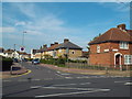
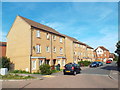


64 photos from this area
Area Information
Key information about the RM9 4SD including its size, population, and administrative classification.
- Area Type
- Postcode
- Area Size
- 9020 m²
- Population
- 1705
- Population Density
- 11678 people/km²
House Prices in RM9 4SD
36
Properties
£224,917
Average Sold Price
£140,000
Lowest Price
£355,000
Highest Price
Showing 36 properties
| Address | Type | Beds | Baths | Last Sale Price | Last Sale Date | |
|---|---|---|---|---|---|---|
| 8 Seton Gardens, Dagenham, RM9 4SD | Terraced | 4 | 1 | £355,000 | Jun 2021 | |
| 24 Seton Gardens, Dagenham, RM9 4SD | house | - | - | £320,000 | Mar 2021 | |
| 29 Seton Gardens, Dagenham, RM9 4SD | Terraced | 3 | 1 | £347,000 | Dec 2018 | |
| 13 Seton Gardens, Dagenham, RM9 4SD | house | - | - | £290,000 | Aug 2017 | |
| 9 Seton Gardens, Dagenham, RM9 4SD | house | - | - | £260,000 | Feb 2016 | |
| 26 Seton Gardens, Dagenham, RM9 4SD | house | - | - | £178,000 | Nov 2013 | |
| 17 Seton Gardens, Dagenham, RM9 4SD | house | 3 | 1 | £185,000 | Oct 2006 | |
| 18 Seton Gardens, Dagenham, RM9 4SD | Terraced | - | - | £155,000 | Dec 2004 | |
| 22 Seton Gardens, Dagenham, RM9 4SD | Terraced | - | - | £160,000 | Sep 2004 | |
| 7 Seton Gardens, Dagenham, RM9 4SD | Terraced | 5 | 3 | £160,000 | May 2004 |
Page 1 of 4
Energy Efficiency in RM9 4SD
Amenities
Schools
| Rank | School | Type | Entry gender | Ages |
|---|
Explore more schools in this area
Go to Schools tabDemographics
Household Size
Family (3-5 people)
most common
Accommodation Type
Houses
most common
Tenure
45
majority
Ethnic Group
White
most common
Religion
N/A
most common
Household Composition
N/A
most common
Age
47
median
Adults (30-64 years)
most common
Household Deprivation
N/A
with no deprivation
NS-SEC
20
in Lower managerial occupations
Explore more demographic insights in this area
Go to Demographics tabPlanning
Planning Constraints
- Flood RiskPremium
- Ramsar Wetland SitesPremium
- Area of Outstanding Natural BeautyPremium
- Protected Nature ReservePremium
- Protected WoodlandPremium