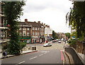
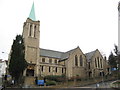
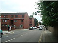
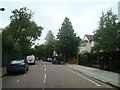
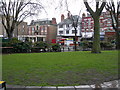
Area Overview for NW6 1DG
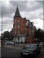
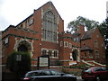
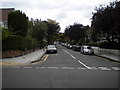
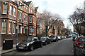
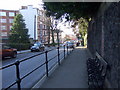
Photos of NW6 1DG

Area Information
NW6 1DG is a compact residential cluster nestled within the greater London landscape, covering just 3907 square metres. This small postcode serves a defined population of 1458 residents, indicating a tight-knit community where neighbours often know one another. Living in NW6 1DG means accessing a specific pocket of housing that forms part of the wider Hampstead and West Hampstead network. You will find this area characterised by high-rise density compared to the national average, as indicated by its significant population density figure of 373,191 inhabitants per square kilometre. Despite the urban intensity, the location offers straightforward access to broader amenities. The postcode represents a slice of London life where proximity to transport hubs and local shops is a key feature of daily existence. Prospective buyers should note that this area functions as a distinct residential zone rather than a sprawling suburb. The characteristics of NW6 1DG are defined by its place within the metropolis, offering a mix of convenience and urban living standards.
- Area Type
- Postcode
- Area Size
- 3907 m²
- Population
- 1458
- Population Density
- 13195 people/km²
The property market in NW6 1DG is defined by a significant concentration of flats, as this is the specified accommodation type for the postcode. This configuration suits the high-density nature of the area where space efficiency is often a priority. With a home ownership rate of 41%, the market contains a substantial number of rental properties alongside private homes. This split indicates that the area accommodates both long-term tenants and owner-occupiers. When looking at places like NW6 1DG, you should expect housing stock that intersperses leasehold apartments with potential freehold units or shared ownership schemes common in such boroughs. The market dynamics reflect the broader London trend where smaller, lighter homes command premium prices relative to their floor area. Buyers focusing on this specific postcode must evaluate the specific title status of every flat, as the majority of stock here will not be traditional detached houses. Understanding the balance between rental and owned stock provides clarity on market competition and potential returns or costs.
House Prices in NW6 1DG
Showing 41 properties
| Address | Type | Beds | Baths | Last Sale Price | Last Sale Date | |
|---|---|---|---|---|---|---|
| 11 Ingham Road, London, NW6 1DG | Terraced | 3 | 1 | £1,275,000 | May 2025 | |
| 35 Ingham Road, London, NW6 1DG | Terraced | 4 | 2 | £1,590,000 | Feb 2025 | |
| 23 Ingham Road, London, NW6 1DG | Detached | 4 | 2 | £1,650,000 | Jul 2023 | |
| 25 Ingham Road, London, NW6 1DG | house | - | - | £1,425,000 | Aug 2021 | |
| 7 Ingham Road, London, NW6 1DG | Semi-detached | 4 | 3 | £1,260,000 | Oct 2013 | |
| 1 Ingham Road, London, NW6 1DG | Terraced | 4 | 3 | £800,000 | Feb 2013 | |
| 29 Ingham Road, London, NW6 1DG | house | 3 | - | £875,000 | Nov 2012 | |
| 17 Ingham Road, London, NW6 1DG | Terraced | 4 | 3 | £453,000 | Apr 2008 | |
| 9 Ingham Road, London, NW6 1DG | house | - | - | £562,000 | Dec 2005 | |
| 13 Ingham Road, London, NW6 1DG | Terraced | - | - | £575,000 | Aug 2002 |
Energy Efficiency in NW6 1DG
Living in NW6 1DG places you within reach of numerous convenient amenities that shape daily life. You have access to five local rail stations including West Hampstead Thameslink Railway Station, West Hampstead Overground Station, and West Hampstead Railway Station. Five metro stations serve the area, such as Kilburn Station, Hampstead Station, and Finchley Road Station, providing extensive underground links. For river travel, five waterbus stops are nearby, including the London Zoo Waterbus Stop and Camden Lock Waterbus. Five bus routes, including connections to London Victoria Coach Station, ensure local mobility. Retail options include Tesco Fortune, Waitrose Little, and Sainsburys West, offering essential shopping needs within practical reach. This network of transport and retail venues ensures that living in NW6 1DG involves minimal travel time to essential services or leisure activities. The density of these facilities supports a self-sufficient lifestyle for most residents.
Amenities
Schools
| Rank | School | Type | Entry gender | Ages |
|---|
Explore more schools in this area
Go to Schools tabDemographics
The community in NW6 1DG reflects a mature demographic profile with a median age of 47 years. The most common age range for residents consists of adults between 30 and 64 years old, suggesting the area appeals to individuals and families in their mid-career phase. House ownership stands at 41%, meaning slightly less than half of the homes in NW6 1DG are owner-occupied. The remaining properties operate within the private rented sector. Flats represent the predominant accommodation type, consistent with the high-density nature of a small postcode area. The area is predominantly White, aligning with the broader socio-economic patterns of North West London. This demographic structure points to a stable neighbourhood where long-term residents form the core of the population. Understanding these figures helps you assess whether the resident profile matches your lifestyle needs when considering homes in NW6 1DG.
Household Size
Accommodation Type
Tenure
Ethnic Group
Religion
Household Composition
Age
Household Deprivation
NS-SEC
Explore more demographic insights in this area
Go to Demographics tabPlanning
Planning Constraints
- Flood RiskPremium
- Ramsar Wetland SitesPremium
- Area of Outstanding Natural BeautyPremium
- Protected Nature ReservePremium
- Protected WoodlandPremium