Area Overview for NW6 1DS
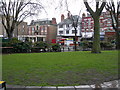
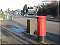
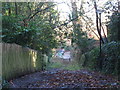
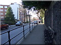
Photos of NW6 1DS
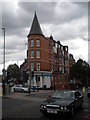
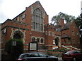
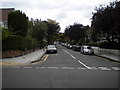
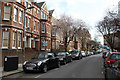
Area Information
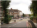
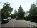
Living in NW6 1DS means residing within a specific residential cluster covering 3,113 square metres. This postcode area hosts a population of 1,458 residents, creating an environment where neighbours are likely to know each other. The density reaches approximately 468,330 people per square kilometre when calculated against the total area size, indicating a tight-knit urban setting. Because the zone is so confined, daily journeys to local shops or stations take just minutes on foot rather than miles. You will find that life here revolves around proximity to major transport hubs like West Hampstead and Kilburn. The area functions as a functional part of North West London, offering direct access to the city without the immediate visual clutter often found in larger suburban sprawls. Residents appreciate the short distances to essentials, making it an efficient base for those working in central London. The compact nature of the postcode means you can navigate the neighbourhood quickly, yet still benefit from the wider infrastructure of the borough. It is a practical choice for buyers prioritising connectivity and convenience over extensive green space within the immediate boundary of this specific cluster.
- Area Type
- Postcode
- Area Size
- 3113 m²
- Population
- 1458
- Population Density
- 13195 people/km²
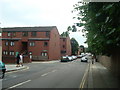
Homes in NW6 1DS are defined by a specific mix of tenure and building style. Flats are the primary accommodation type here, suiting the high-density footprint of a 3,113 square metre area. With 41% of households in the postcode owning their homes, the area presents a split market where investors and landlords coexist with long-term owner-occupiers. This balance suggests a steady demand for both rental yields and secure family living spaces. Prospective buyers looking at this postcode area will find that most properties are purpose-built flats designed to maximise space in an urban setting. The concentration of flats indicates that the architecture prioritises vertical living over large gardens or sprawl. While home ownership is significant, the presence of private and social landlords ensures a wide range of entry points into the market. Those seeking a flat here can choose from various entry prices, though the overall character remains that of a established, high-density inner London block. The stock is mature, reflecting decades of urban development rather than a new-build explosion.
House Prices in NW6 1DS
Showing 68 properties
| Address | Type | Beds | Baths | Last Sale Price | Last Sale Date | |
|---|---|---|---|---|---|---|
| 72B Fortune Green Road, London, NW6 1DS | Flat | 2 | 2 | £250,000 | Feb 2016 | |
| Former Upper Flat, 102 Fortune Green Road, London, NW6 1DS | Flat | 2 | 2 | £415,000 | Mar 2005 | |
| Former Flat A, 86 Fortune Green Road, London, NW6 1DS | Flat | 3 | 2 | - | - | |
| Flat 2ND And 3RD Floor, 78 Fortune Green Road, London, NW6 1DS | Flat | 3 | 2 | - | - | |
| Flat 1, 74 Fortune Green Road, London, NW6 1DS | Flat | 2 | 2 | - | - | |
| Flat A, 94 Fortune Green Road, London, NW6 1DS | Flat | 1 | 1 | - | - | |
| Flat A, 106 Fortune Green Road, London, NW6 1DS | Maisonette | 3 | - | - | - | |
| Flat Ground Floor, 68 Fortune Green Road, London, NW6 1DS | Flat | 4 | 3 | - | - | |
| Studio Flat, 88 Fortune Green Road, London, NW6 1DS | Terraced | 10 | 6 | - | - | |
| Bombay Nights, 90 Fortune Green Road, London, NW6 1DS | Retail | - | - | - | - |
Energy Efficiency in NW6 1DS
Residents of NW6 1DS enjoy immediate access to a diverse range of amenities within practical walking distance. Five retail outlets serve the area, including Tesco Fortune, Waitrose Little, and Sainsburys West. These supermarkets provide daily necessities without the need for car travel. For public transport, the location offers five nearby rail connections, with West Hampstead Thameslink Railway Station, West Hampstead Overground Station, and West Hampstead Railway Station located nearby. You can also reach five metro stations, including Kilburn Station, Hampstead Station, and Finchley Road Station, for Tube travel across the city. Water transport is available via the London Zoo Waterbus Stop, Camden Lock Waterbus, and Little Venice Waterbus Stop, adding a scenic element to your daily commute options. Three bus services link the area to London Victoria Coach Station Arrivals, Victoria Coach Station, and the Green Line Coach Station for national travel or inter-city trips. This network ensures you can reach work, school, or leisure activities quickly from your doorstep.
Amenities
Schools
| Rank | School | Type | Entry gender | Ages |
|---|
Explore more schools in this area
Go to Schools tabDemographics
The community in NW6 1DS reflects an older demographic profile with a median age of 47 years. Adults aged between 30 and 64 years make up the most common age range within this postcode, suggesting a settlement of established residents rather than young newcomers. Home ownership stands at 41%, meaning just over two out of every five households own their property outright or with a mortgage. The remaining majority live in rented accommodation, which is consistent with the predominant building type of flats in this location. White residents form the predominant ethnic group in the area, shaping the cultural character of the local streets. This age distribution implies a population that may be downsizing or maintaining their current living space during their peak earning years. The high proportion of flats aligns with the urban density required to house a larger-than-average population relative to the land area. Buyers should expect a neighbourhood familiar to professionals and families seeking stability rather than student markets or retirement enclaves.
Household Size
Accommodation Type
Tenure
Ethnic Group
Religion
Household Composition
Age
Household Deprivation
NS-SEC
Explore more demographic insights in this area
Go to Demographics tabPlanning
Planning Constraints
- Flood RiskPremium
- Ramsar Wetland SitesPremium
- Area of Outstanding Natural BeautyPremium
- Protected Nature ReservePremium
- Protected WoodlandPremium