Area Overview for NW6 1DE
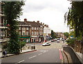
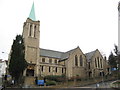
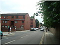
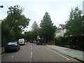
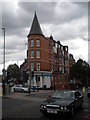
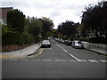
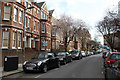
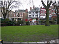
Photos of NW6 1DE


Area Information
Living in NW6 1DE means residing within a very small residential cluster covering just 5012 square metres in England. This compact site accommodates a population of 1458 people, creating an environment where density is the primary defining feature. With a population density of 290,927 people per square kilometre, the neighbourhood feels intimate yet intensively used. You will find yourself in a specific postcode area that represents a focused living space rather than a sprawling district. The sheer concentration of residents in such a limited footprint suggests a locality where daily life revolves closely around immediate surroundings. Prospective buyers should expect a setting where every square metre of land holds significant residential value. The area lacks the vast open spaces typical of suburban blends, focusing instead on maximising utility within its confined boundaries. Daily routines here likely involve navigating tight streets and accessing local hubs quickly rather than driving to distant centres. Understanding the sheer scale of this postcode helps frame expectations about noise, shared resources, and community interaction. You are entering a micro-community where proximity defines the rhythm of daily existence for its inhabitants.
- Area Type
- Postcode
- Area Size
- 5012 m²
- Population
- 1458
- Population Density
- 13195 people/km²
The property market in NW6 1DE is heavily skewed towards rental arrangements, with only 41% of residents owning their homes. The predominant accommodation type in this postcode is flats, which aligns with the extremely high population density of 290,927 people per square kilometre. Buyers looking at this small 5012 square metre area will find a stock dominated by shared units rather than standalone family houses. This concentration of flats suggests the housing supply is optimised for multiple households within limited footprint. You should anticipate a market where competition for flats is the norm, particularly given the limited total area available. The lower home ownership percentage indicates that investment properties or private rentals may hold significant weight in the local economy. If you are considering buying a flat in NW6 1DE, be aware that the absence of traditional terraced or semi-detached stock alters the typical London landscape. The 41% ownership rate also means resale dynamics might differ from more established owner-occupier estates. Prospective purchasers must evaluate whether the flat-specific infrastructure, such as shared entrance halls or communal grounds, meets their long-term needs. Understanding that this is primarily a flat market helps clarify the type of boundaries and communal agreements you will encounter here.
House Prices in NW6 1DE
Showing 37 properties
| Address | Type | Beds | Baths | Last Sale Price | Last Sale Date | |
|---|---|---|---|---|---|---|
| 46 Ingham Road, London, NW6 1DE | house | - | - | £1,190,000 | Jan 2025 | |
| 44 Ingham Road, London, NW6 1DE | Terraced | 3 | 1 | £1,160,000 | Feb 2024 | |
| 38 Ingham Road, London, NW6 1DE | Detached | 4 | 3 | £1,450,000 | Jan 2022 | |
| 42 Ingham Road, London, NW6 1DE | Terraced | 4 | 2 | £1,510,000 | Feb 2020 | |
| 12 Ingham Road, London, NW6 1DE | Terraced | 3 | 1 | £1,300,000 | Apr 2018 | |
| 30 Ingham Road, London, NW6 1DE | Terraced | 3 | 2 | £1,385,000 | Sep 2016 | |
| 24 Ingham Road, London, NW6 1DE | house | - | - | £999,999 | Nov 2013 | |
| 32 Ingham Road, London, NW6 1DE | Flat | 2 | 1 | £1,100,000 | Oct 2013 | |
| 18 Ingham Road, London, NW6 1DE | house | 4 | - | £1,168,000 | Aug 2011 | |
| 26 Ingham Road, London, NW6 1DE | Flat | 4 | - | £725,000 | Oct 2010 |
Energy Efficiency in NW6 1DE
Your daily life in NW6 1DE benefits from an extensive array of amenities located within practical reach. Five major railway stations, including West Hampstead Thameslink Railway Station and West Hampstead Overground Station, provide seamless rail access to the wider city. You can also access five metro hubs such as Kilburn Station and Hampstead Station for underground travel. The area offers five rail layouts with notable stops like Finchley Road Station and West Hampstead Railway Station, ensuring flexibility in your commute choices. Three bus routes connect you to key destinations including London Victoria Coach Station Arrivals and Green Line Coach Station. For shopping needs, residents can visit five retailers, notably Tesco Fortune, Waitrose Little, and Sainsburys West. Leisure time might include trips to five ferry options, ranging from the London Zoo Waterbus Stop to Little Venice Waterbus Stop. This dense network of transport and retail services ensures you rarely struggle to find a shop, school, or station nearby. The presence of such diverse amenities within close proximity supports the needs of the 1458 local population without requiring long commutes to distant high streets. You will find that the convenience of having Tesco Fortune and major tube lines nearby defines the rhythm of your week. The variety of transport modes means you can walk, take the bus, or drive coaches without significant planning. This connectivity network is a decisive factor for anyone considering homes in NW6 1DE.
Amenities
Schools
| Rank | School | Type | Entry gender | Ages |
|---|
Explore more schools in this area
Go to Schools tabDemographics
The community character of NW6 1DE is defined by a mature population with a median age of 47 years. Adults aged between 30 and 64 years form the most common age range within this cluster. This demographic profile suggests an area settled by those established in their careers and families, moving away from the volatility of younger entry-level markets. Only 41% of residents own their homes fully, indicating a significant portion of the population rents or shares accommodation. The dominant accommodation type found here is flats, reflecting the space-constrained nature of the 5012 square metre site. The predominant ethnic group in neighbourhood is White, forming the core cultural demographic of the local cluster. These statistics paint a picture of a stable, though not entirely owner-occupier, residential zone. The high density of 290,927 people per square kilometre combined with a median age over 45 implies residents value convenience over large private gardens. You will encounter a mix of long-term tenants and owner-occupiers who have adapted to a high-rise or high-density flat living arrangement. This age distribution offers a sense of stability and established local knowledge, rather than the transience often associated with student hubs.
Household Size
Accommodation Type
Tenure
Ethnic Group
Religion
Household Composition
Age
Household Deprivation
NS-SEC
Explore more demographic insights in this area
Go to Demographics tabPlanning
Planning Constraints
- Flood RiskPremium
- Ramsar Wetland SitesPremium
- Area of Outstanding Natural BeautyPremium
- Protected Nature ReservePremium
- Protected WoodlandPremium