Area Overview for NW1 1DA
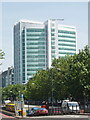
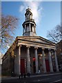
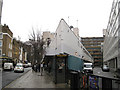
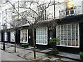
Photos of NW1 1DA


Area Information
Living in NW1 1DA means residing in a small residential cluster covering 2804 m² within the heart of St Pancras and Somers Town in the London Borough of Camden. This postcode area holds a population of 1505 residents, creating an environment that feels distinctively compact yet densely connected. The location sits within a ward bounded by Euston Road, Eversholt Street, Crowndale Road, Pancras Road, and the railway approaches to St Pancras Station. This central position places you amidst three major railway termini, including Euston, which opened in 1838, Kings Cross in 1852, and St Pancras in 1868. Historically, the area evolved from Georgian developments around the 1780s following factory overhauls in the early 19th century. Lord Somers accepted the London and Birmingham Railway Company's proposal to build Euston Station within Somers Town in 1834. The ward remains home to significant landmarks such as St Pancras Old Church, which stands on Pancras Road historically positioned on a knoll. Despite its rich history involving the Mosquitos family and the Sidney Street estate, the neighbourhood today functions primarily as a dense, residential zone defined by its proximity to national transport hubs. The area is characterised by specific boundaries that separate it from the wider St Pancras and Somers Town ward, yet it shares the same foundational infrastructure and historical layers.
- Area Type
- Postcode
- Area Size
- 2804 m²
- Population
- 1505
- Population Density
- 9477 people/km²
The property market in NW1 1DA is fundamentally shaped by the accommodation type data, which identifies flats as the primary housing stock. A home ownership rate of 13% confirms that renting is the dominant mode of occupancy for buyers and movers considering this specific postcode. This low ownership figure usually indicates a area where investors or housing associations manage the bulk of the housing units rather than private landlords holding single-family tenures. The property stock does not comprise detached houses or large semi-detached homes but focuses strictly on flat-living arrangements within a 2804 m² zone. For those looking at homes in NW1 1DA, the market operates within a framework of high demand for rental properties due to the location's centrality. The area forms part of the St Pancras and Somers Town ward, where surviving Georgian houses nearby have seen increased sought-after status, yet the specific 1505-population cluster remains defined by blocks named after saints, such as those in the Sidney Street estate. These social housing blocks, including St George's, represent the first all-electric apartment block in the United Kingdom. Consequently, buyers or renters here encounter a market where price elasticity often mirrors the 13% ownership ceiling, suggesting that purchasing a freehold property is statistically rare compared to committing to a lease arrangement within these flats.
House Prices in NW1 1DA
Showing 65 properties
| Address | Type | Beds | Baths | Last Sale Price | Last Sale Date | |
|---|---|---|---|---|---|---|
| 58C Eversholt Street, London, NW1 1DA | Terraced | 5 | - | - | - | |
| 58B Eversholt Street, London, NW1 1DA | Flat | 2 | 1 | - | - | |
| FLAT 3, 50-52 EVERSHOLT STREET, London, NW1 1DA | Flat | - | - | - | - | |
| 54 Eversholt Street, London, NW1 1DA | Flat | - | - | - | - | |
| Flat 1ST Floor, 54 Eversholt Street, London, NW1 1DA | Flat | 5 | - | - | - | |
| Flat 2ND Floor, 54 Eversholt Street, London, NW1 1DA | Flat | - | - | - | - | |
| Flat 1ST And 2ND Floor, 48 Eversholt Street, London, NW1 1DA | Flat | 5 | 2 | - | - | |
| Flat 4, 66 Eversholt Street, London, NW1 1DA | Flat | - | - | - | - | |
| Flat 3, 66 Eversholt Street, London, NW1 1DA | Flat | - | - | - | - | |
| Flat 1ST And 2ND Floor, 40-42 Eversholt Street, London, NW1 1DA | Unknown | - | - | - | - |
Energy Efficiency in NW1 1DA
Daily life in NW1 1DA is defined by immediate access to five retail outlets, five rail termini, five metro stations, and three bus facilities. Residents can shop at venues including M&S Euston Rail SF, Sainsburys London, and M&S St Pancras Rail Arcade SF. Commuting options are equally extensive, with London Euston Railway Station and London St Pancras International providing direct links to the Midlands, the North, and continental Europe. Water transport is also available via five ferry points, including the Camden Lock Waterbus, London Zoo Waterbus Stop, and Savoy Pier. Convenience extends to leisure and dining, with the area situated near the diverse mix of Sainsburys and M&S stores. The presence of five metro stations, such as Warren Street Station and Mornington Crescent, reduces reliance on private vehicles. Historically, the area was shaped by Father Basil Jellicoe's improvements and the construction of St Pancras Station in 1868, embedding a sense of organised infrastructure into the lifestyle. Whether accessing the Green Line Coach Station for long-distance travel or utilizing the nearby Camden Lock Waterbus for tourist experiences, the amenities ensure that practical needs are met within walking distance of the 2804 m² residential zone.
Amenities
Schools
| Rank | School | Type | Entry gender | Ages |
|---|
Explore more schools in this area
Go to Schools tabDemographics
The community in NW1 1DA is defined by a median age of 22 years, indicating a population skewed heavily towards younger residents. While the most common age range for adults in the broader context is 30 to 64 years, the specific microscopic nature of this postcode cluster suggests a demographic heavily influenced by students, young professionals, or transient populations typical of such central London locations. Home ownership stands at a low 13%, which signals that the vast majority of residents live in rented accommodation. This statistic aligns closely with the predominant accommodation type, which consists of flats. Diversity is a key feature of daily life here, with the predominant ethnic group identified as Asian. This mix contributes to the cultural fabric of St Pancras and Somers Town, an area known for serving less affluent residents and refugees alongside the student body. The area is recorded as being among the 10% most deprived areas in the country. This deprivation level reflects a concentration of dense, Council-owned residential blocks that have historically maintained a distinct social composition compared to gentrified neighbouring wards. The character of the neighbourhood remains consistent with these figures, housing a population where tenancy and multi-tenanted units dominate the social landscape.
Household Size
Accommodation Type
Tenure
Ethnic Group
Religion
Household Composition
Age
Household Deprivation
NS-SEC
Explore more demographic insights in this area
Go to Demographics tabPlanning
Planning Constraints
- Flood RiskPremium
- Ramsar Wetland SitesPremium
- Area of Outstanding Natural BeautyPremium
- Protected Nature ReservePremium
- Protected WoodlandPremium