Area Overview for N9 9BT
Photos of N9 9BT
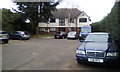
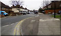
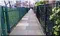
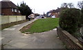
45 photos from this area
Area Information
Key information about the N9 9BT including its size, population, and administrative classification.
- Area Type
- Postcode
- Area Size
- 7706 m²
- Population
- 1561
- Population Density
- 6838 people/km²
House Prices in N9 9BT
25
Properties
£268,291
Average Sold Price
£155,000
Lowest Price
£535,000
Highest Price
Showing 25 properties
| Address | Type | Beds | Baths | Last Sale Price | Last Sale Date | |
|---|---|---|---|---|---|---|
| 23 Westerham Avenue, Edmonton, N9 9BT | house | - | - | £535,000 | Mar 2022 | |
| 19 Westerham Avenue, Edmonton, N9 9BT | Flat | - | - | £287,500 | May 2021 | |
| 7A Westerham Avenue, Edmonton, N9 9BT | Flat | 1 | 1 | £203,000 | Mar 2018 | |
| 29 Westerham Avenue, Edmonton, N9 9BT | house | - | - | £240,000 | Mar 2012 | |
| 19A Westerham Avenue, Edmonton, N9 9BT | Flat | 2 | 1 | £155,000 | Jun 2011 | |
| 1 Westerham Avenue, Edmonton, N9 9BT | house | - | - | £317,500 | Aug 2009 | |
| 11 Westerham Avenue, Edmonton, N9 9BT | Terraced | 4 | 2 | £279,995 | Apr 2007 | |
| 5 Westerham Avenue, Edmonton, N9 9BT | house | - | - | £295,000 | Jan 2007 | |
| 21 Westerham Avenue, Edmonton, N9 9BT | Terraced | 3 | 2 | £249,995 | Jul 2006 | |
| 15 Westerham Avenue, Edmonton, N9 9BT | Terraced | - | - | £247,000 | Aug 2004 |
Page 1 of 3
Energy Efficiency in N9 9BT
Amenities
Schools
| Rank | School | Type | Entry gender | Ages |
|---|
Explore more schools in this area
Go to Schools tabDemographics
Household Size
Family (3-5 people)
most common
Accommodation Type
Houses
most common
Tenure
65
majority
Ethnic Group
White
most common
Religion
N/A
most common
Household Composition
N/A
most common
Age
47
median
Adults (30-64 years)
most common
Household Deprivation
N/A
with no deprivation
NS-SEC
22
in Lower managerial occupations
Explore more demographic insights in this area
Go to Demographics tabPlanning
Planning Constraints
- Flood RiskPremium
- Ramsar Wetland SitesPremium
- Area of Outstanding Natural BeautyPremium
- Protected Nature ReservePremium
- Protected WoodlandPremium