Area Overview for N9 9BP
Photos of N9 9BP
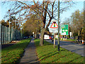
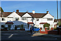
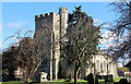
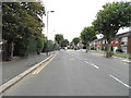
16 photos from this area
Area Information
Key information about the N9 9BP including its size, population, and administrative classification.
- Area Type
- Postcode
- Area Size
- 1.7 hectares
- Population
- 1560
- Population Density
- 5959 people/km²
House Prices in N9 9BP
38
Properties
£254,719
Average Sold Price
£70,000
Lowest Price
£535,000
Highest Price
Showing 38 properties
| Address | Type | Beds | Baths | Last Sale Price | Last Sale Date | |
|---|---|---|---|---|---|---|
| 45 Westerham Avenue, Edmonton, N9 9BP | house | - | - | £535,000 | Mar 2025 | |
| 63 Westerham Avenue, Edmonton, N9 9BP | Terraced | 3 | 2 | £484,000 | Dec 2021 | |
| 75 Westerham Avenue, Edmonton, N9 9BP | Terraced | 4 | 2 | £500,000 | Sep 2017 | |
| 77 Westerham Avenue, Edmonton, N9 9BP | house | 1 | 1 | £290,000 | Oct 2014 | |
| 41 Westerham Avenue, Edmonton, N9 9BP | Semi-detached | 3 | - | £280,000 | Nov 2013 | |
| 69 Westerham Avenue, Edmonton, N9 9BP | house | - | - | £365,000 | Sep 2013 | |
| 39 Westerham Avenue, Edmonton, N9 9BP | Semi-detached | 3 | 1 | £270,000 | Jul 2008 | |
| 83 Westerham Avenue, Edmonton, N9 9BP | Terraced | - | - | £320,000 | Dec 2007 | |
| 73 Westerham Avenue, Edmonton, N9 9BP | Terraced | - | - | £265,000 | Jan 2007 | |
| 99 Westerham Avenue, Edmonton, N9 9BP | Flat | - | - | £250,000 | Jan 2007 |
Page 1 of 4
Energy Efficiency in N9 9BP
Amenities
Schools
| Rank | School | Type | Entry gender | Ages |
|---|
Explore more schools in this area
Go to Schools tabDemographics
Household Size
Family (3-5 people)
most common
Accommodation Type
Houses
most common
Tenure
63
majority
Ethnic Group
White
most common
Religion
N/A
most common
Household Composition
N/A
most common
Age
47
median
Adults (30-64 years)
most common
Household Deprivation
N/A
with no deprivation
NS-SEC
23
in Lower managerial occupations
Explore more demographic insights in this area
Go to Demographics tabPlanning
Planning Constraints
- Flood RiskPremium
- Ramsar Wetland SitesPremium
- Area of Outstanding Natural BeautyPremium
- Protected Nature ReservePremium
- Protected WoodlandPremium