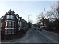
Area Overview for N8 7HB
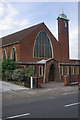
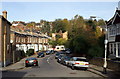
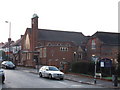
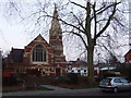
Photos of N8 7HB


Area Information
Living in N8 7HB means inhabiting a compact, densely populated residential cluster in north London. The area covers 7,219 square metres, housing 1,429 people in a space where every square metre is utilised. This is a small, tightly woven community, characterised by its proximity to transport hubs and retail centres. The population density of 197,959 people per square kilometre reflects a highly urbanised environment, where daily life is shaped by the immediacy of amenities. Residents benefit from being near major retail outlets like Co-op Muswell, Tesco Hornsey, and Sainsburys Hornsey, as well as multiple rail and metro stations. The area’s low flood risk and safety score of 84/100 suggest a stable, secure living environment. While the population is small, the density fosters a sense of community, with shared access to public transport and local services. For those seeking a compact, well-connected postcode with minimal environmental risk, N8 7HB offers a blend of convenience and practicality.
- Area Type
- Postcode
- Area Size
- 7219 m²
- Population
- 1429
- Population Density
- 7704 people/km²
The property market in N8 7HB is dominated by owner-occupied homes, with 74% of residents owning their properties. This high rate of home ownership suggests a stable, long-term market with limited rental activity. The area’s accommodation is primarily houses, which contrasts with higher-density urban areas where flats are more common. This housing stock may appeal to buyers seeking family homes or larger properties, though the small area size and high population density imply limited scope for expansion. The proximity to multiple retail and transport hubs adds to the area’s practicality, making it attractive for commuters or those prioritising convenience. However, the compact nature of N8 7HB means buyers must consider the immediate surroundings for additional housing options. The market’s stability and focus on owner-occupation may make it less volatile than areas with higher rental demand, but property availability is likely constrained by the postcode’s small size.
House Prices in N8 7HB
Showing 25 properties
| Address | Type | Beds | Baths | Last Sale Price | Last Sale Date | |
|---|---|---|---|---|---|---|
| 19A Warner Road, Hornsey, London, N8 7HB | Semi-detached | 4 | 1 | £470,000 | Jun 2023 | |
| 41 Warner Road, Hornsey, London, N8 7HB | Retail | 4 | 2 | £1,410,000 | Feb 2022 | |
| 9 Warner Road, Hornsey, London, N8 7HB | Terraced | 4 | 2 | £1,520,000 | Oct 2021 | |
| 51 Warner Road, Hornsey, London, N8 7HB | Terraced | 4 | 1 | £1,225,000 | Aug 2020 | |
| 11 Warner Road, Hornsey, London, N8 7HB | Semi-detached | 5 | 3 | £1,595,000 | Nov 2019 | |
| 13 Warner Road, Hornsey, London, N8 7HB | house | 4 | - | £1,450,000 | Jan 2019 | |
| 33 Warner Road, Hornsey, London, N8 7HB | Terraced | 4 | 2 | £1,400,000 | Mar 2016 | |
| 43 Warner Road, Hornsey, London, N8 7HB | Terraced | 4 | 1 | £1,345,000 | Dec 2015 | |
| 23 Warner Road, Hornsey, London, N8 7HB | Terraced | 4 | - | £1,210,000 | Dec 2015 | |
| 49 Warner Road, Hornsey, London, N8 7HB | house | - | - | £1,200,000 | Nov 2014 |
Energy Efficiency in N8 7HB
Residents of N8 7HB enjoy a range of amenities within walking or short transit distance. The area is served by five retail outlets, including Co-op Muswell, Tesco Hornsey, and Sainsburys Hornsey, providing everyday shopping convenience. Transport links are extensive, with rail, metro, and ferry options such as Camden Lock Waterbus and London Zoo Waterbus Stop offering access to wider London. The presence of multiple stations, including Turnpike Lane and Highgate, facilitates easy travel to central London or surrounding areas. While specific parks or leisure facilities are not detailed in the data, the proximity to transport hubs suggests access to nearby green spaces or cultural attractions. The compact nature of the area means amenities are tightly clustered, reducing the need for long commutes. This density supports a lifestyle where daily errands, work, and leisure can be managed efficiently, though the lack of detailed leisure data leaves room for further exploration of local offerings.
Amenities
Schools
| Rank | School | Type | Entry gender | Ages |
|---|
Explore more schools in this area
Go to Schools tabDemographics
The demographic profile of N8 7HB is defined by a median age of 47, with the majority of residents falling within the 30-64 age range. This suggests a community of established adults, likely focused on long-term living rather than transient populations. Home ownership is high at 74%, indicating a stable housing market where most residents are either homeowners or long-term renters. The predominant accommodation type is houses, which aligns with the area’s residential character. Ethnically, the population is predominantly White, though no specific data on diversity or deprivation is provided. The absence of detailed diversity metrics means the community’s social fabric remains less defined in the data. The high home ownership rate and adult demographic suggest a mature, settled population, with fewer young families or students. This profile may influence local services and amenities, which are tailored to the needs of middle-aged residents.
Household Size
Accommodation Type
Tenure
Ethnic Group
Religion
Household Composition
Age
Household Deprivation
NS-SEC
Explore more demographic insights in this area
Go to Demographics tabPlanning
Planning Constraints
- Flood RiskPremium
- Ramsar Wetland SitesPremium
- Area of Outstanding Natural BeautyPremium
- Protected Nature ReservePremium
- Protected WoodlandPremium