Area Overview for N8 7HG
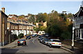
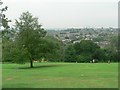
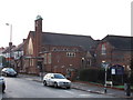
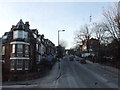
Photos of N8 7HG


Area Information
N8 7HG is a compact residential cluster in north London, covering just 2.7 hectares yet housing 1,429 people. Its high population density of 52,758 people per square kilometre reflects a tightly knit community. This area is defined by its proximity to transport hubs and local amenities, making it a practical choice for those prioritising connectivity. Daily life here revolves around nearby shops, schools, and public transport, with a mix of older residents and families. The area’s small size means it feels intimate, though its density can create a bustling atmosphere. Residents benefit from being close to major rail and metro lines, which link to central London and beyond. While the space is limited, the concentration of services within walking distance suggests a well-planned urban environment. For buyers, N8 7HG offers a blend of convenience and affordability, though its size means it’s more suited to those seeking a compact, connected lifestyle rather than expansive properties.
- Area Type
- Postcode
- Area Size
- 2.7 hectares
- Population
- 1429
- Population Density
- 7704 people/km²
N8 7HG is primarily an owner-occupied area, with 74% of homes owned by residents rather than rented. The accommodation type is predominantly houses, which is notable in a part of London typically associated with flats. This suggests a market skewed towards family homes and long-term buyers seeking stability. The small area size means the housing stock is limited, which could drive competition among buyers. The high home ownership rate indicates a community with established roots, though the lack of rental properties may make it less appealing to those requiring flexibility. For buyers, the focus on houses means properties are likely to be larger than average for the area, but the compact nature of N8 7HG means space is at a premium. Proximity to transport links may offset the limitations of the area’s size, making it attractive to commuters.
House Prices in N8 7HG
Showing 30 properties
| Address | Type | Beds | Baths | Last Sale Price | Last Sale Date | |
|---|---|---|---|---|---|---|
| 93 Redston Road, Hornsey, London, N8 7HG | Terraced | 5 | 2 | £1,775,000 | Jan 2023 | |
| 119 Redston Road, Hornsey, London, N8 7HG | Terraced | - | - | £1,050,000 | Jul 2016 | |
| 85 Redston Road, Hornsey, London, N8 7HG | house | - | - | £1,350,000 | Nov 2015 | |
| 87 Redston Road, Hornsey, London, N8 7HG | Terraced | 5 | 2 | £1,550,000 | Jun 2015 | |
| 95 Redston Road, Hornsey, London, N8 7HG | house | - | - | £950,000 | Nov 2012 | |
| 113 Redston Road, Hornsey, London, N8 7HG | Terraced | - | - | £900,000 | Aug 2008 | |
| 83 Redston Road, Hornsey, London, N8 7HG | Semi-detached | - | - | £690,000 | Apr 2003 | |
| 99 Redston Road, Hornsey, London, N8 7HG | house | 5 | - | £750,000 | Nov 2002 | |
| 89 Redston Road, Hornsey, London, N8 7HG | Terraced | - | - | £497,000 | Jul 2000 | |
| 125 Redston Road, Hornsey, London, N8 7HG | Terraced | - | - | £324,000 | Oct 1999 |
Energy Efficiency in N8 7HG
Living in N8 7HG offers access to a range of amenities within practical reach. Retail options include Co-op Muswell, Tesco Hornsey, and Sainsburys Hornsey, providing everyday shopping convenience. Transport links are extensive, with rail stations like Alexandra Palace and Hornsey, as well as metro stops at Wood Green and Turnpike Lane. Ferry services, such as the Camden Lock Waterbus and Little Venice Waterbus Stop, add a unique dimension to local travel. The area’s proximity to London Zoo and Little Venice highlights its blend of urban and leisure opportunities. While the density of the area may limit green spaces, the variety of shops, transport, and water-based connectivity ensures a dynamic lifestyle. Residents can enjoy a mix of retail, transport, and recreational activities, making daily life both practical and varied.
Amenities
Schools
| Rank | School | Type | Entry gender | Ages |
|---|
Explore more schools in this area
Go to Schools tabDemographics
The population of N8 7HG has a median age of 47, with the majority of residents aged between 30 and 64. This suggests a community of established professionals and families, rather than a younger or elderly demographic. Home ownership is high at 74%, indicating a stable, long-term resident base. The area is predominantly composed of houses, which is unusual for inner London, and the predominant ethnic group is White. The population density of 52,758 people per square kilometre is exceptionally high, reflecting a densely populated urban environment. This density may influence the availability of private outdoor space but ensures proximity to amenities. The age profile and ownership rates suggest a community focused on stability, with fewer transient residents. However, the lack of diversity data beyond ethnicity means the full picture of social dynamics remains incomplete.
Household Size
Accommodation Type
Tenure
Ethnic Group
Religion
Household Composition
Age
Household Deprivation
NS-SEC
Explore more demographic insights in this area
Go to Demographics tabPlanning
Planning Constraints
- Flood RiskPremium
- Ramsar Wetland SitesPremium
- Area of Outstanding Natural BeautyPremium
- Protected Nature ReservePremium
- Protected WoodlandPremium