Area Overview for N8 7EY
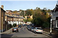
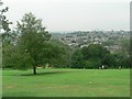
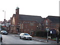
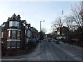
Photos of N8 7EY


Area Information
Living in N8 7EY means inhabiting a tightly packed residential cluster in north London, where 1,429 people reside across 5,625 square metres. This small area is densely populated, with 254,039 people per square kilometre, creating a compact, community-driven environment. The postcode is a mix of established homes and proximity to transport hubs, making it appealing for commuters. Daily life here is defined by convenience: major retail stores like Co-op Muswell and Tesco Hornsey are within walking distance, while rail and metro stations offer swift access to central London. The area’s character is shaped by its blend of residential calm and urban connectivity, with a median age of 47 suggesting a mature, settled population. For those seeking a balance between suburban comfort and city accessibility, N8 7EY offers a snapshot of London’s residential diversity, though its small size means choices are limited to immediate surroundings.
- Area Type
- Postcode
- Area Size
- 5625 m²
- Population
- 1429
- Population Density
- 7704 people/km²
The property market in N8 7EY is characterised by high home ownership (74%) and a predominance of houses over flats. This suggests a market skewed towards owner-occupiers rather than renters, with a focus on single-family homes. The small area size—just 5,625 square metres—means the housing stock is limited, and buyers may need to look beyond immediate surroundings for more options. The concentration of houses implies a quieter, more private living experience compared to high-density developments. However, the compact nature of the area could limit availability for those seeking larger properties or specific layouts. For buyers, this small postcode may serve as a starting point, with nearby areas offering broader choices. The market’s stability, driven by long-term residents, may provide a reliable investment opportunity, though competition for properties could be fierce.
House Prices in N8 7EY
Showing 14 properties
| Address | Type | Beds | Baths | Last Sale Price | Last Sale Date | |
|---|---|---|---|---|---|---|
| 72 Priory Road, Hornsey, London, N8 7EY | Terraced | 5 | 3 | £1,000,000 | Jan 2023 | |
| 90 Priory Road, Hornsey, London, N8 7EY | house | 4 | 2 | £1,445,120 | Feb 2021 | |
| 94 Priory Road, Hornsey, London, N8 7EY | house | 5 | - | £985,000 | Oct 2013 | |
| 82 Priory Road, Hornsey, London, N8 7EY | house | 4 | - | £843,500 | Jan 2012 | |
| 86 Priory Road, Hornsey, London, N8 7EY | house | - | - | £720,000 | Apr 2009 | |
| 92 Priory Road, Hornsey, London, N8 7EY | Terraced | 4 | 2 | £625,000 | Oct 2006 | |
| 84 Priory Road, Hornsey, London, N8 7EY | Terraced | - | - | £257,000 | May 1998 | |
| 76 Priory Road, Hornsey, London, N8 7EY | Terraced | 3 | 1 | - | - | |
| 96A Priory Road, Hornsey, London, N8 7EY | Detached | 1 | 1 | - | - | |
| 80 Priory Road, Hornsey, London, N8 7EY | Terraced | - | - | - | - |
Energy Efficiency in N8 7EY
Residents of N8 7EY benefit from a range of amenities within walking or short transit distance. Retail options include Co-op Muswell, Tesco Hornsey, and Asda Crouch, offering everyday shopping convenience. Transport links are extensive, with rail, metro, and ferry services connecting to key destinations like Highgate, Wood Green, and London Zoo. The area’s proximity to Alexandra Palace Station and Whipps Cross Bus Interchange ensures easy access to employment hubs and leisure spots. For leisure, the nearby London Zoo Waterbus Stop and Little Venice Waterbus Stop provide scenic travel options. The compact layout means amenities are densely packed, reducing the need for long commutes. This mix of retail, transport, and leisure facilities fosters a lifestyle where daily needs are met locally, though the area’s small size means choices remain limited to immediate surroundings.
Amenities
Schools
| Rank | School | Type | Entry gender | Ages |
|---|
Explore more schools in this area
Go to Schools tabDemographics
The community in N8 7EY is predominantly composed of adults aged 30–64, with a median age of 47. This age group dominates, reflecting a mature, stable population. Home ownership is high at 74%, indicating a strong presence of long-term residents. The area is largely made up of houses, not flats, which aligns with the higher proportion of owner-occupied properties. The predominant ethnic group is White, though specific data on diversity or deprivation is not provided. The high population density—254,039 people per square kilometre—suggests a tightly packed living environment, which may influence the availability of private space. For residents, this density means proximity to amenities but also potential challenges in finding larger properties. The age profile and ownership rates suggest a community focused on stability, with fewer young families or transient populations.
Household Size
Accommodation Type
Tenure
Ethnic Group
Religion
Household Composition
Age
Household Deprivation
NS-SEC
Explore more demographic insights in this area
Go to Demographics tabPlanning
Planning Constraints
- Flood RiskPremium
- Ramsar Wetland SitesPremium
- Area of Outstanding Natural BeautyPremium
- Protected Nature ReservePremium
- Protected WoodlandPremium