Area Overview for N8 0FF
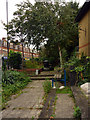
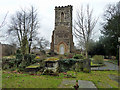
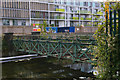
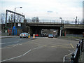
Photos of N8 0FF


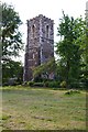
Area Information
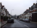
N8 0FF is a small, densely populated residential postcode in England, covering just 3,322 square metres and home to 1,564 residents. Its high population density of 470,734 people per square kilometre reflects a compact, urbanised cluster of homes. This area is characterised by its proximity to transport hubs, with multiple rail, metro, and ferry services within reach, making it a practical choice for commuters. The community here is predominantly composed of adults aged 30–64, suggesting a mature demographic with established lifestyles. While the area lacks natural reserves or protected landscapes, its strategic location near Hornsey and Wood Green ensures access to retail, leisure, and cultural amenities. Living in N8 0FF means navigating a tight-knit, high-density environment where convenience is balanced by the need for efficient transport and shared spaces. The area’s small size means every resident is likely within walking distance of key services, though the limited housing stock—primarily flats—highlights its focus on rental properties over owner-occupied homes.
- Area Type
- Postcode
- Area Size
- 3322 m²
- Population
- 1564
- Population Density
- 5616 people/km²
The property market in N8 0FF is defined by its high density and limited housing stock. With 42% of residents owning their homes, the area leans more towards rental properties than owner-occupied ones, suggesting a transient or younger demographic among renters. The accommodation type is exclusively flats, which is typical for urban postcode areas with constrained space. This means buyers considering homes in N8 0FF should expect to focus on shared spaces and potentially smaller units. The small area size and proximity to transport hubs make it a practical choice for those prioritising convenience over expansive living spaces. However, the limited availability of properties—particularly for purchase—may make the market competitive. For buyers, the challenge lies in balancing the advantages of central connectivity with the constraints of a small, densely populated postcode.
House Prices in N8 0FF
Showing 58 properties
Energy Efficiency in N8 0FF
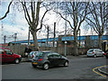
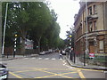
Living in N8 0FF offers access to a range of amenities within easy reach. Retail options include Iceland Wood, Lidl Wood, and Sainsburys Hornsey, providing everyday shopping convenience. The area’s transport links are extensive, with rail stations such as Hornsey and Alexandra Palace, plus metro stops like Wood Green and Turnpike Lane, ensuring seamless travel across London. Ferry services, including the London Zoo Waterbus Stop and Camden Lock Waterbus, add flexibility for leisure trips. While there is only one bus interchange, the proximity to multiple rail and metro lines compensates for this. The compact nature of the area means residents can access these amenities without long commutes, fostering a lifestyle that balances urban convenience with the need for efficient mobility.
Amenities
Schools
| Rank | School | Type | Entry gender | Ages |
|---|
Explore more schools in this area
Go to Schools tabDemographics
The population of N8 0FF is predominantly adults aged 30–64, with a median age of 47. This suggests a community of established professionals and families, though the 42% home ownership rate indicates that nearly two-thirds of residents are renters. The accommodation type is overwhelmingly flats, reflecting a housing stock tailored to urban living rather than detached homes. The predominant ethnic group is White, though no further breakdown of diversity is provided. The age profile and ownership data imply a stable, long-term resident base, though the lack of younger households may affect local schools and childcare facilities. The absence of specific data on deprivation means that quality of life factors such as access to services or green spaces must be inferred from the available amenities. The area’s compact size and mature demographic create a distinct character, shaped by routine and proximity to transport networks.
Household Size
Accommodation Type
Tenure
Ethnic Group
Religion
Household Composition
Age
Household Deprivation
NS-SEC
Explore more demographic insights in this area
Go to Demographics tabPlanning
Planning Constraints
- Flood RiskPremium
- Ramsar Wetland SitesPremium
- Area of Outstanding Natural BeautyPremium
- Protected Nature ReservePremium
- Protected WoodlandPremium