Area Overview for N8 0FR
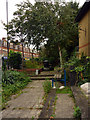
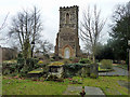
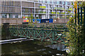
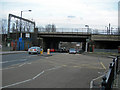
Photos of N8 0FR


Area Information
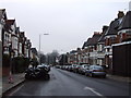
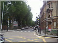
Living in N8 0FR means inhabiting a densely populated, compact residential area in north London. The postcode covers just 1.2 hectares, yet it hosts 1,564 residents, making it one of the most densely populated places in England, with 133,464 people per square kilometre. This small cluster is characterised by its mix of flats, reflecting a community where 42% of homes are owner-occupied and the rest are likely rented. The area’s proximity to multiple transport hubs, including rail, metro, and ferry services, ensures easy access to central London and beyond. Daily life here is shaped by its compact size, with residents relying on nearby amenities such as Sainsburys Hornsey and Morrisons High for shopping. The median age of 47 suggests a mature population, with many residents in the 30–64 age range. While the area lacks natural landscapes or protected sites, its strategic location near Alexandra Palace Station and Wood Green Station makes it a practical choice for commuters. The absence of flood risk or environmental constraints adds to its appeal, though crime rates are average, requiring standard precautions.
- Area Type
- Postcode
- Area Size
- 1.2 hectares
- Population
- 1564
- Population Density
- 5616 people/km²
The property market in N8 0FR is defined by its limited size and high density, with flats making up the vast majority of homes. Only 42% of properties are owner-occupied, suggesting that the area functions more as a rental market than a place for long-term homeownership. The compact nature of the postcode means that the housing stock is constrained, and buyers must consider the scarcity of available properties. Flats dominate, which may appeal to those seeking affordability or proximity to transport links. However, the small area size means that buyers should look beyond N8 0FR to nearby postcodes for more options. The lack of protected landscapes or planning constraints may also make it easier to find properties, though the high population density could impact living space per person. For those prioritising convenience over space, the area’s proximity to multiple transport hubs adds value.
House Prices in N8 0FR
Showing 67 properties
Energy Efficiency in N8 0FR
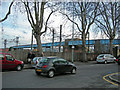
Residents of N8 0FR have access to a range of amenities within practical reach, enhancing daily life. Retail options include Iceland Wood, Sainsburys Hornsey, and Morrisons High, providing grocery and household essentials. Transport links are extensive, with rail, metro, and ferry services at Hornsey, Alexandra Palace, and Wood Green stations, enabling quick travel to work or leisure. The Camden Lock Waterbus and London Zoo Waterbus Stop offer scenic routes along the Thames. The Whipps Cross Bus Interchange adds further connectivity. While the area lacks parks or natural spaces, its proximity to transport hubs and retail centres creates a convenience-focused lifestyle. The compact size means amenities are close, reducing the need for long commutes. However, the absence of green spaces or recreational facilities may be a consideration for those seeking outdoor activities.
Amenities
Schools
| Rank | School | Type | Entry gender | Ages |
|---|
Explore more schools in this area
Go to Schools tabDemographics
The community in N8 0FR is predominantly composed of adults aged 30–64, with a median age of 47. This suggests a population that is largely established, with fewer young families or elderly residents. Home ownership is relatively low at 42%, indicating that a significant proportion of residents are likely renting. The accommodation type is almost entirely flats, which aligns with the area’s compact size and high population density. The predominant ethnic group is White, though specific data on diversity or deprivation is not provided. The high population density of 133,464 people per square kilometre implies a tightly packed residential environment, which may influence the character of local interactions and the availability of shared spaces. The age profile and ownership figures suggest a community that is stable but not rapidly growing, with a focus on long-term residency over new development.
Household Size
Accommodation Type
Tenure
Ethnic Group
Religion
Household Composition
Age
Household Deprivation
NS-SEC
Explore more demographic insights in this area
Go to Demographics tabPlanning
Planning Constraints
- Flood RiskPremium
- Ramsar Wetland SitesPremium
- Area of Outstanding Natural BeautyPremium
- Protected Nature ReservePremium
- Protected WoodlandPremium