Area Overview for N8 0JU
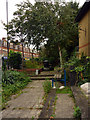
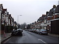
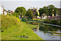
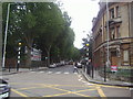
Photos of N8 0JU


Area Information
Living in N8 0JU means inhabiting a compact, high-density postcode area in north London. Spanning just 1.3 hectares, this small residential cluster is home to 1,564 people, resulting in a population density of 123,505 people per square kilometre. The area is defined by its proximity to key transport hubs and retail centres, making it a practical choice for those prioritising connectivity. Residents benefit from nearby stations such as Hornsey, Alexandra Palace, and Bounds Green, which link to the broader London transport network. The area’s compact size means daily life is centred around nearby amenities, from supermarkets like Iceland Wood and Sainsburys to ferry services at Camden Lock and Blackfriars Pier. While the population is small, the density creates a tightly knit environment, though it also means space is limited. The area’s appeal lies in its accessibility and the balance between urban convenience and residential comfort. For buyers, N8 0JU offers a snapshot of London’s smaller, more focused postcode communities, where proximity to services and transport outweighs the constraints of limited land.
- Area Type
- Postcode
- Area Size
- 1.3 hectares
- Population
- 1564
- Population Density
- 5616 people/km²
The property market in N8 0JU is characterised by a high proportion of rental properties, with only 42% of homes owned by residents. This suggests a market skewed towards tenants rather than owner-occupiers, which may influence the types of properties available. The accommodation is almost exclusively flats, reflecting the area’s small size and density. For buyers, this means limited scope for purchasing larger homes or detached properties, with most options confined to smaller, shared spaces. The compact nature of the area also means that property values are likely constrained by the limited land available. Buyers should consider whether the rental-focused market aligns with their long-term goals, as ownership opportunities may be scarce. The prevalence of flats also implies a need for proximity to communal amenities, as private outdoor space is minimal. For those seeking a smaller, centrally located property with easy access to transport and services, N8 0JU may be appealing, but it is not a destination for those prioritising spacious, independent living.
House Prices in N8 0JU
Showing 69 properties
| Address | Type | Beds | Baths | Last Sale Price | Last Sale Date | |
|---|---|---|---|---|---|---|
| 77 Hornsey Park Road, Wood Green, London, N8 0JU | house | 3 | 1 | £750,000 | May 2024 | |
| 65 Hornsey Park Road, Wood Green, London, N8 0JU | Detached | 3 | 2 | £620,000 | Dec 2019 | |
| 47 Hornsey Park Road, Wood Green, London, N8 0JU | Terraced | 4 | 2 | £603,000 | Mar 2018 | |
| 75 Hornsey Park Road, Wood Green, London, N8 0JU | Terraced | 6 | 2 | £472,000 | Oct 2017 | |
| 61 Hornsey Park Road, Wood Green, London, N8 0JU | Flat | 1 | 1 | £637,000 | Jan 2016 | |
| 105 Hornsey Park Road, Wood Green, London, N8 0JU | Terraced | 3 | 1 | £440,000 | Apr 2014 | |
| 83 Hornsey Park Road, Wood Green, London, N8 0JU | house | 3 | - | £390,000 | May 2011 | |
| 63 Hornsey Park Road, Wood Green, London, N8 0JU | house | 3 | - | £340,000 | Sep 2010 | |
| 67 Hornsey Park Road, Wood Green, London, N8 0JU | Terraced | 3 | 1 | £369,950 | Nov 2007 | |
| 71 Hornsey Park Road, Wood Green, London, N8 0JU | Terraced | - | - | £162,000 | May 2000 |
Energy Efficiency in N8 0JU
Residents of N8 0JU have access to a range of amenities within practical reach, enhancing daily life. Retail options include supermarkets like Iceland Wood and Sainsburys Hornsey, ensuring convenience for grocery shopping. Transport links are extensive, with rail services at Hornsey and Alexandra Palace stations, as well as metro stops at Turnpike Lane and Wood Green. Ferry services, such as Camden Lock Waterbus and Blackfriars Pier, provide alternative routes, particularly for those near the Thames. The area’s proximity to these services means residents can easily access both urban and suburban destinations. While the data does not specify dining or leisure venues, the presence of major supermarkets and transport hubs suggests a functional, service-oriented lifestyle. The compact nature of the area means amenities are closely clustered, reducing travel time but also limiting the diversity of options. For those prioritising convenience over variety, N8 0JU offers a streamlined, accessible environment.
Amenities
Schools
| Rank | School | Type | Entry gender | Ages |
|---|
Explore more schools in this area
Go to Schools tabDemographics
The community in N8 0JU is predominantly composed of adults aged 30–64, with a median age of 47. This suggests a mature population, likely with established careers and families. Home ownership here is relatively low at 42%, indicating that a majority of residents are likely renting. The accommodation type is almost entirely flats, reflecting the area’s high density and compact footprint. The predominant ethnic group is White, though no specific data on diversity or deprivation is provided. The age profile and housing stock suggest a stable, possibly working-age population, with limited presence of younger or older demographics. The absence of detailed diversity statistics means the community’s composition remains partially opaque, but the data implies a focus on practical living over luxury or novelty. The high population density, combined with the flat-dominated housing, points to a pragmatic approach to urban living, prioritising space efficiency over expansive homes.
Household Size
Accommodation Type
Tenure
Ethnic Group
Religion
Household Composition
Age
Household Deprivation
NS-SEC
Explore more demographic insights in this area
Go to Demographics tabPlanning
Planning Constraints
- Flood RiskPremium
- Ramsar Wetland SitesPremium
- Area of Outstanding Natural BeautyPremium
- Protected Nature ReservePremium
- Protected WoodlandPremium