Area Overview for N12 7AN
Photos of N12 7AN


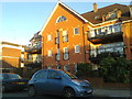

82 photos from this area
Area Information
Key information about the N12 7AN including its size, population, and administrative classification.
- Area Type
- Postcode
- Area Size
- 9260 m²
- Population
- 1538
- Population Density
- 2999 people/km²
House Prices in N12 7AN
17
Properties
£607,445
Average Sold Price
£210,000
Lowest Price
£925,000
Highest Price
Showing 17 properties
| Address | Type | Beds | Baths | Last Sale Price | Last Sale Date | |
|---|---|---|---|---|---|---|
| 4 Cissbury Ring North, North Finchley, London, N12 7AN | house | - | - | £925,000 | Sep 2020 | |
| 32 Cissbury Ring North, North Finchley, London, N12 7AN | Semi-detached | 5 | 2 | £920,000 | Sep 2020 | |
| 12 Cissbury Ring North, North Finchley, London, N12 7AN | house | 3 | 1 | £785,000 | Dec 2016 | |
| 18 Cissbury Ring North, North Finchley, London, N12 7AN | house | 3 | 1 | £700,000 | Apr 2015 | |
| 24 Cissbury Ring North, North Finchley, London, N12 7AN | house | - | - | £682,000 | Mar 2012 | |
| 30 Cissbury Ring North, North Finchley, London, N12 7AN | house | 4 | - | £660,000 | May 2011 | |
| 20 Cissbury Ring North, North Finchley, London, N12 7AN | Semi-detached | - | - | £489,950 | Feb 2007 | |
| 34 Cissbury Ring North, North Finchley, London, N12 7AN | Detached | 4 | 2 | £472,500 | Jul 2004 | |
| 2 Cissbury Ring North, North Finchley, London, N12 7AN | Semi-detached | 3 | 1 | £230,000 | Jul 1999 | |
| 16 Cissbury Ring North, North Finchley, London, N12 7AN | Semi-detached | 3 | 1 | £210,000 | May 1999 |
Page 1 of 2
Energy Efficiency in N12 7AN
Amenities
Schools
| Rank | School | Type | Entry gender | Ages |
|---|
Explore more schools in this area
Go to Schools tabDemographics
Household Size
Family (3-5 people)
most common
Accommodation Type
Houses
most common
Tenure
83
majority
Ethnic Group
White
most common
Religion
N/A
most common
Household Composition
N/A
most common
Age
47
median
Adults (30-64 years)
most common
Household Deprivation
N/A
with no deprivation
NS-SEC
54
in Lower managerial occupations
Explore more demographic insights in this area
Go to Demographics tabPlanning
Planning Constraints
- Flood RiskPremium
- Ramsar Wetland SitesPremium
- Area of Outstanding Natural BeautyPremium
- Protected Nature ReservePremium
- Protected WoodlandPremium