Area Overview for N12 7AH
Photos of N12 7AH

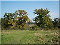
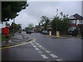
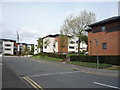
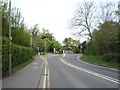
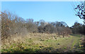
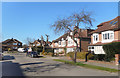
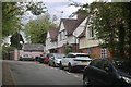


36 photos from this area
Area Information
Key information about the N12 7AH including its size, population, and administrative classification.
- Area Type
- Postcode
- Area Size
- 8908 m²
- Population
- 1538
- Population Density
- 2999 people/km²
House Prices in N12 7AH
17
Properties
£631,765
Average Sold Price
£150,000
Lowest Price
£1,285,000
Highest Price
Showing 17 properties
| Address | Type | Beds | Baths | Last Sale Price | Last Sale Date | |
|---|---|---|---|---|---|---|
| 40 Cissbury Ring North, North Finchley, London, N12 7AH | house | 4 | 2 | £1,285,000 | Mar 2025 | |
| 60 Cissbury Ring North, North Finchley, London, N12 7AH | Semi-detached | 4 | 2 | £775,000 | Dec 2020 | |
| 62 Cissbury Ring North, North Finchley, London, N12 7AH | Semi-detached | 3 | 1 | £825,000 | Sep 2018 | |
| 56 Cissbury Ring North, North Finchley, London, N12 7AH | house | - | - | £776,000 | Jul 2018 | |
| 52 Cissbury Ring North, North Finchley, London, N12 7AH | Semi-detached | 3 | 1 | £770,000 | Feb 2016 | |
| 64 Cissbury Ring North, North Finchley, London, N12 7AH | house | 3 | 1 | £715,000 | Jul 2015 | |
| 58 Cissbury Ring North, North Finchley, London, N12 7AH | Semi-detached | 3 | 2 | £740,000 | May 2015 | |
| 54 Cissbury Ring North, North Finchley, London, N12 7AH | Semi-detached | 3 | 1 | £675,000 | Mar 2014 | |
| 46 Cissbury Ring North, North Finchley, London, N12 7AH | Semi-detached | - | - | £583,000 | Dec 2007 | |
| 36 Cissbury Ring North, North Finchley, London, N12 7AH | Semi-detached | 3 | 1 | £402,500 | Dec 2005 |
Page 1 of 2
Energy Efficiency in N12 7AH
Amenities
Schools
| Rank | School | Type | Entry gender | Ages |
|---|
Explore more schools in this area
Go to Schools tabDemographics
Household Size
Family (3-5 people)
most common
Accommodation Type
Houses
most common
Tenure
83
majority
Ethnic Group
White
most common
Religion
N/A
most common
Household Composition
N/A
most common
Age
47
median
Adults (30-64 years)
most common
Household Deprivation
N/A
with no deprivation
NS-SEC
54
in Lower managerial occupations
Explore more demographic insights in this area
Go to Demographics tabPlanning
Planning Constraints
- Flood RiskPremium
- Ramsar Wetland SitesPremium
- Area of Outstanding Natural BeautyPremium
- Protected Nature ReservePremium
- Protected WoodlandPremium