Area Overview for N12 7LT
Photos of N12 7LT


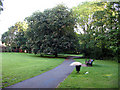


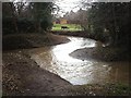


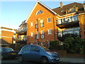

82 photos from this area
Area Information
Key information about the N12 7LT including its size, population, and administrative classification.
- Area Type
- Postcode
- Area Size
- 9772 m²
- Population
- 1476
- Population Density
- 5361 people/km²
House Prices in N12 7LT
21
Properties
£590,405
Average Sold Price
£140,000
Lowest Price
£950,000
Highest Price
Showing 21 properties
| Address | Type | Beds | Baths | Last Sale Price | Last Sale Date | |
|---|---|---|---|---|---|---|
| 15 Lullington Garth, North Finchley, London, N12 7LT | Retail | 3 | 1 | £850,000 | May 2022 | |
| 23 Lullington Garth, North Finchley, London, N12 7LT | Semi-detached | 3 | - | £815,000 | Mar 2021 | |
| 21 Lullington Garth, North Finchley, London, N12 7LT | Semi-detached | 4 | 2 | £910,000 | Mar 2020 | |
| 11 Lullington Garth, North Finchley, London, N12 7LT | Semi-detached | 3 | 1 | £785,000 | May 2019 | |
| 9 Lullington Garth, North Finchley, London, N12 7LT | house | 3 | 1 | £750,000 | Jun 2018 | |
| 39 Lullington Garth, North Finchley, London, N12 7LT | house | 4 | 2 | £950,000 | Dec 2017 | |
| 3 Lullington Garth, North Finchley, London, N12 7LT | house | 3 | - | £482,500 | Jul 2010 | |
| 25 Lullington Garth, North Finchley, London, N12 7LT | Semi-detached | - | - | £369,950 | Apr 2004 | |
| 5 Lullington Garth, North Finchley, London, N12 7LT | Semi-detached | 3 | 2 | £250,000 | Jun 2000 | |
| 19 Lullington Garth, North Finchley, London, N12 7LT | Semi-detached | - | - | £192,000 | Jan 1998 |
Page 1 of 3
Energy Efficiency in N12 7LT
Amenities
Schools
| Rank | School | Type | Entry gender | Ages |
|---|
Explore more schools in this area
Go to Schools tabDemographics
Household Size
Family (3-5 people)
most common
Accommodation Type
Houses
most common
Tenure
78
majority
Ethnic Group
White
most common
Religion
N/A
most common
Household Composition
N/A
most common
Age
47
median
Adults (30-64 years)
most common
Household Deprivation
N/A
with no deprivation
NS-SEC
57
in Lower managerial occupations
Explore more demographic insights in this area
Go to Demographics tabPlanning
Planning Constraints
- Flood RiskPremium
- Ramsar Wetland SitesPremium
- Area of Outstanding Natural BeautyPremium
- Protected Nature ReservePremium
- Protected WoodlandPremium