Area Overview for IG11 9BP
Photos of IG11 9BP
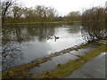

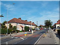
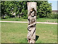
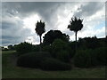
48 photos from this area
Area Information
Key information about the IG11 9BP including its size, population, and administrative classification.
- Area Type
- Postcode
- Area Size
- 1.2 hectares
- Population
- 2499
- Population Density
- 10204 people/km²
House Prices in IG11 9BP
33
Properties
£352,315
Average Sold Price
£85,000
Lowest Price
£740,000
Highest Price
Showing 33 properties
| Address | Type | Beds | Baths | Last Sale Price | Last Sale Date | |
|---|---|---|---|---|---|---|
| 162 Westrow Drive, Barking, IG11 9BP | Terraced | 5 | 2 | £707,000 | Jan 2025 | |
| 138 Westrow Drive, Barking, IG11 9BP | house | - | - | £357,821 | Oct 2023 | |
| 146 Westrow Drive, Barking, IG11 9BP | Terraced | 3 | 1 | £500,000 | Dec 2022 | |
| 172 Westrow Drive, Barking, IG11 9BP | house | - | - | £740,000 | Jan 2022 | |
| 176 Westrow Drive, Barking, IG11 9BP | house | - | - | £530,000 | May 2021 | |
| 148 Westrow Drive, Barking, IG11 9BP | Terraced | 3 | 1 | £460,000 | Dec 2020 | |
| 142 Westrow Drive, Barking, IG11 9BP | Terraced | 3 | 1 | £415,000 | Aug 2018 | |
| 174 Westrow Drive, Barking, IG11 9BP | Terraced | 3 | 1 | £440,000 | Mar 2018 | |
| 136 Westrow Drive, Barking, IG11 9BP | Terraced | 3 | - | £485,000 | Mar 2017 | |
| 118 Westrow Drive, Barking, IG11 9BP | house | - | - | £375,000 | Jan 2016 |
Page 1 of 4
Energy Efficiency in IG11 9BP
Amenities
Schools
| Rank | School | Type | Entry gender | Ages |
|---|
Explore more schools in this area
Go to Schools tabDemographics
Household Size
Family (3-5 people)
most common
Accommodation Type
Houses
most common
Tenure
62
majority
Ethnic Group
asian_total
most common
Religion
N/A
most common
Household Composition
N/A
most common
Age
47
median
Adults (30-64 years)
most common
Household Deprivation
N/A
with no deprivation
NS-SEC
23
in Lower managerial occupations
Explore more demographic insights in this area
Go to Demographics tabPlanning
Planning Constraints
- Flood RiskPremium
- Ramsar Wetland SitesPremium
- Area of Outstanding Natural BeautyPremium
- Protected Nature ReservePremium
- Protected WoodlandPremium