Area Overview for IG11 9AT
Photos of IG11 9AT

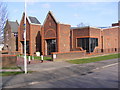
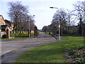


24 photos from this area
Area Information
Key information about the IG11 9AT including its size, population, and administrative classification.
- Area Type
- Postcode
- Area Size
- 1.2 hectares
- Population
- 2499
- Population Density
- 10204 people/km²
House Prices in IG11 9AT
38
Properties
£306,545
Average Sold Price
£150,000
Lowest Price
£670,000
Highest Price
Showing 38 properties
| Address | Type | Beds | Baths | Last Sale Price | Last Sale Date | |
|---|---|---|---|---|---|---|
| 33 Southwold Drive, Barking, IG11 9AT | Terraced | 3 | 1 | £440,000 | Apr 2024 | |
| 49 Southwold Drive, Barking, IG11 9AT | Terraced | 3 | 2 | £670,000 | Oct 2023 | |
| 5 Southwold Drive, Barking, IG11 9AT | Retail | 3 | - | £425,000 | May 2022 | |
| 13 Southwold Drive, Barking, IG11 9AT | house | 3 | - | £345,000 | Mar 2021 | |
| 31 Southwold Drive, Barking, IG11 9AT | Terraced | 3 | 1 | £412,000 | Oct 2020 | |
| 61 Southwold Drive, Barking, IG11 9AT | Terraced | 3 | 1 | £425,000 | May 2019 | |
| 23 Southwold Drive, Barking, IG11 9AT | Terraced | 6 | 3 | £383,000 | Feb 2018 | |
| 15 Southwold Drive, Barking, IG11 9AT | Terraced | 3 | 1 | £397,500 | Dec 2017 | |
| 59 Southwold Drive, Barking, IG11 9AT | Terraced | 3 | 3 | £315,000 | Dec 2015 | |
| 69 Southwold Drive, Barking, IG11 9AT | Terraced | 3 | - | £239,000 | Oct 2013 |
Page 1 of 4
Energy Efficiency in IG11 9AT
Amenities
Schools
| Rank | School | Type | Entry gender | Ages |
|---|
Explore more schools in this area
Go to Schools tabDemographics
Household Size
Family (3-5 people)
most common
Accommodation Type
Houses
most common
Tenure
62
majority
Ethnic Group
asian_total
most common
Religion
N/A
most common
Household Composition
N/A
most common
Age
47
median
Adults (30-64 years)
most common
Household Deprivation
N/A
with no deprivation
NS-SEC
23
in Lower managerial occupations
Explore more demographic insights in this area
Go to Demographics tabPlanning
Planning Constraints
- Flood RiskPremium
- Ramsar Wetland SitesPremium
- Area of Outstanding Natural BeautyPremium
- Protected Nature ReservePremium
- Protected WoodlandPremium