Area Overview for HA3 8SX
Photos of HA3 8SX

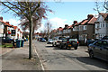
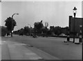
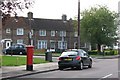
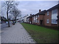
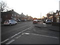
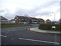
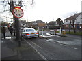
54 photos from this area
Area Information
Key information about the HA3 8SX including its size, population, and administrative classification.
- Area Type
- Postcode
- Area Size
- 3974 m²
- Population
- 1570
- Population Density
- 9203 people/km²
House Prices in HA3 8SX
10
Properties
£264,000
Average Sold Price
£105,000
Lowest Price
£465,000
Highest Price
Showing 10 properties
| Address | Type | Beds | Baths | Last Sale Price | Last Sale Date | |
|---|---|---|---|---|---|---|
| 196 Kenton Lane, Harrow Weald, HA3 8SX | Semi-detached | 3 | 2 | £280,000 | Sep 2023 | |
| 200 Kenton Lane, Harrow Weald, HA3 8SX | Semi-detached | 3 | 1 | £330,000 | Nov 2011 | |
| 192 Kenton Lane, Harrow Weald, HA3 8SX | Semi-detached | 3 | 1 | £465,000 | Nov 2006 | |
| 210 Kenton Lane, Harrow Weald, HA3 8SX | house | - | - | £140,000 | Jun 1998 | |
| 204 Kenton Lane, Harrow Weald, HA3 8SX | Semi-detached | - | - | £105,000 | Dec 1995 | |
| 198 Kenton Lane, Harrow Weald, HA3 8SX | Semi-detached | 4 | 2 | - | - | |
| 194 Kenton Lane, Harrow Weald, HA3 8SX | house | - | - | - | - | |
| 206 Kenton Lane, Harrow Weald, HA3 8SX | Semi-detached | - | - | - | - | |
| 208 Kenton Lane, Harrow Weald, HA3 8SX | Semi-detached | - | - | - | - | |
| 202 Kenton Lane, Harrow Weald, HA3 8SX | Semi-detached | - | - | - | - |
Energy Efficiency in HA3 8SX
Amenities
Schools
| Rank | School | Type | Entry gender | Ages |
|---|
Explore more schools in this area
Go to Schools tabDemographics
Household Size
Family (3-5 people)
most common
Accommodation Type
Houses
most common
Tenure
73
majority
Ethnic Group
asian_total
most common
Religion
N/A
most common
Household Composition
N/A
most common
Age
47
median
Adults (30-64 years)
most common
Household Deprivation
N/A
with no deprivation
NS-SEC
30
in Lower managerial occupations
Explore more demographic insights in this area
Go to Demographics tabPlanning
Planning Constraints
- Flood RiskPremium
- Ramsar Wetland SitesPremium
- Area of Outstanding Natural BeautyPremium
- Protected Nature ReservePremium
- Protected WoodlandPremium