Area Overview for HA3 8TL
Photos of HA3 8TL

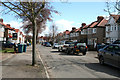
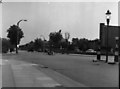
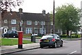
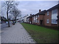
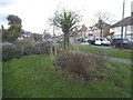
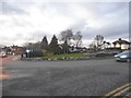
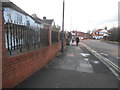
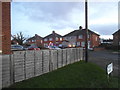
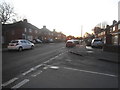
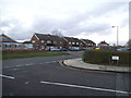
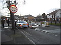
54 photos from this area
Area Information
Key information about the HA3 8TL including its size, population, and administrative classification.
- Area Type
- Postcode
- Area Size
- 1.5 hectares
- Population
- 1568
- Population Density
- 7539 people/km²
House Prices in HA3 8TL
36
Properties
£337,469
Average Sold Price
£102,500
Lowest Price
£775,000
Highest Price
Showing 36 properties
| Address | Type | Beds | Baths | Last Sale Price | Last Sale Date | |
|---|---|---|---|---|---|---|
| 191 Kenton Lane, Harrow Weald, HA3 8TL | Semi-detached | 4 | 1 | £732,000 | Nov 2022 | |
| 181 Kenton Lane, Harrow Weald, HA3 8TL | Semi-detached | 5 | 2 | £775,000 | Jun 2022 | |
| 183 Kenton Lane, Harrow Weald, HA3 8TL | Semi-detached | 4 | - | £530,000 | Mar 2013 | |
| 155 Kenton Lane, Harrow Weald, HA3 8TL | house | 5 | 2 | £457,500 | Jan 2013 | |
| 201 Kenton Lane, Harrow Weald, HA3 8TL | Semi-detached | 3 | 1 | £388,000 | Feb 2012 | |
| 173 Kenton Lane, Harrow Weald, HA3 8TL | Semi-detached | 6 | 4 | £490,000 | Feb 2007 | |
| 157 Kenton Lane, Harrow Weald, HA3 8TL | Terraced | - | - | £335,000 | Oct 2004 | |
| 159 Kenton Lane, Harrow Weald, HA3 8TL | Semi-detached | - | - | £318,000 | Jun 2004 | |
| 161 Kenton Lane, Harrow Weald, HA3 8TL | Semi-detached | - | - | £340,000 | Jun 2003 | |
| 197 Kenton Lane, Harrow Weald, HA3 8TL | Flat | 5 | 1 | £338,000 | Oct 2002 |
Page 1 of 4
Energy Efficiency in HA3 8TL
Amenities
Schools
| Rank | School | Type | Entry gender | Ages |
|---|
Explore more schools in this area
Go to Schools tabDemographics
Household Size
Family (3-5 people)
most common
Accommodation Type
Houses
most common
Tenure
78
majority
Ethnic Group
asian_total
most common
Religion
N/A
most common
Household Composition
N/A
most common
Age
47
median
Adults (30-64 years)
most common
Household Deprivation
N/A
with no deprivation
NS-SEC
32
in Lower managerial occupations
Explore more demographic insights in this area
Go to Demographics tabPlanning
Planning Constraints
- Flood RiskPremium
- Ramsar Wetland SitesPremium
- Area of Outstanding Natural BeautyPremium
- Protected Nature ReservePremium
- Protected WoodlandPremium