Area Overview for HA7 2LB
Photos of HA7 2LB

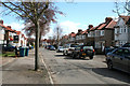
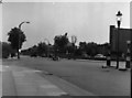
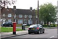
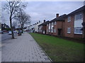
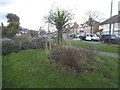
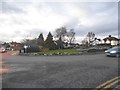
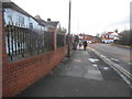
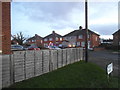
54 photos from this area
Area Information
Key information about the HA7 2LB including its size, population, and administrative classification.
- Area Type
- Postcode
- Area Size
- 1.3 hectares
- Population
- 1416
- Population Density
- 7643 people/km²
House Prices in HA7 2LB
35
Properties
£378,417
Average Sold Price
£85,000
Lowest Price
£815,000
Highest Price
Showing 35 properties
| Address | Type | Beds | Baths | Last Sale Price | Last Sale Date | |
|---|---|---|---|---|---|---|
| 13 Ennerdale Avenue, Kenton, HA7 2LB | Semi-detached | 5 | 3 | £815,000 | Feb 2025 | |
| 41 Ennerdale Avenue, Kenton, HA7 2LB | Terraced | - | - | £600,000 | Sep 2021 | |
| 33 Ennerdale Avenue, Kenton, HA7 2LB | house | - | - | £632,000 | May 2021 | |
| 45 Ennerdale Avenue, Kenton, HA7 2LB | house | - | - | £620,101 | Mar 2021 | |
| 65 Ennerdale Avenue, Kenton, HA7 2LB | Semi-detached | 5 | 3 | £565,000 | Dec 2019 | |
| 35 Ennerdale Avenue, Kenton, HA7 2LB | Semi-detached | 3 | 1 | £545,000 | Nov 2017 | |
| 37 Ennerdale Avenue, Kenton, HA7 2LB | house | - | - | £575,000 | Feb 2017 | |
| 11 Ennerdale Avenue, Kenton, HA7 2LB | house | 4 | - | £460,600 | Jun 2013 | |
| 57 Ennerdale Avenue, Kenton, HA7 2LB | house | 4 | - | £385,000 | Jul 2010 | |
| 61 Ennerdale Avenue, Kenton, HA7 2LB | house | - | - | £280,000 | Aug 2009 |
Page 1 of 4
Energy Efficiency in HA7 2LB
Amenities
Schools
| Rank | School | Type | Entry gender | Ages |
|---|
Explore more schools in this area
Go to Schools tabDemographics
Household Size
Family (3-5 people)
most common
Accommodation Type
Houses
most common
Tenure
81
majority
Ethnic Group
asian_total
most common
Religion
N/A
most common
Household Composition
N/A
most common
Age
47
median
Adults (30-64 years)
most common
Household Deprivation
N/A
with no deprivation
NS-SEC
33
in Lower managerial occupations
Explore more demographic insights in this area
Go to Demographics tabPlanning
Planning Constraints
- Flood RiskPremium
- Ramsar Wetland SitesPremium
- Area of Outstanding Natural BeautyPremium
- Protected Nature ReservePremium
- Protected WoodlandPremium