Area Overview for EN5 2BT
Photos of EN5 2BT
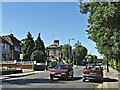
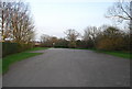
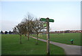
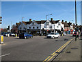
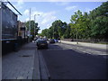
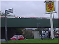
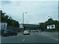
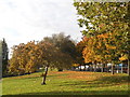
97 photos from this area
Area Information
Key information about the EN5 2BT including its size, population, and administrative classification.
- Area Type
- Postcode
- Area Size
- 1.7 hectares
- Population
- 1548
- Population Density
- 4588 people/km²
House Prices in EN5 2BT
28
Properties
£425,468
Average Sold Price
£75,000
Lowest Price
£625,000
Highest Price
Showing 28 properties
| Address | Type | Beds | Baths | Last Sale Price | Last Sale Date | |
|---|---|---|---|---|---|---|
| 72 Western Way, Barnet, EN5 2BT | Semi-detached | 3 | 1 | £600,000 | May 2024 | |
| 86 Western Way, Barnet, EN5 2BT | Semi-detached | 3 | 1 | £600,000 | Jul 2023 | |
| 58 Western Way, Barnet, EN5 2BT | Semi-detached | 3 | 1 | £600,000 | Jun 2021 | |
| 88 Western Way, Barnet, EN5 2BT | house | - | - | £600,000 | Feb 2020 | |
| 54 Western Way, Barnet, EN5 2BT | Semi-detached | 3 | 1 | £530,000 | Feb 2019 | |
| 94 Western Way, Barnet, EN5 2BT | Semi-detached | 3 | 1 | £575,000 | Sep 2017 | |
| Brookview House, 102 Western Way, Barnet, EN5 2BT | Semi-detached | 4 | 1 | £625,000 | May 2017 | |
| 78 Western Way, Barnet, EN5 2BT | Semi-detached | 3 | - | £551,000 | Aug 2015 | |
| 98 Western Way, Barnet, EN5 2BT | Semi-detached | 4 | - | £485,000 | Jan 2015 | |
| 66 Western Way, Barnet, EN5 2BT | Semi-detached | 3 | - | £404,000 | Mar 2014 |
Page 1 of 3
Energy Efficiency in EN5 2BT
Amenities
Schools
| Rank | School | Type | Entry gender | Ages |
|---|
Explore more schools in this area
Go to Schools tabDemographics
Household Size
Family (3-5 people)
most common
Accommodation Type
Houses
most common
Tenure
75
majority
Ethnic Group
White
most common
Religion
N/A
most common
Household Composition
N/A
most common
Age
47
median
Adults (30-64 years)
most common
Household Deprivation
N/A
with no deprivation
NS-SEC
43
in Lower managerial occupations
Explore more demographic insights in this area
Go to Demographics tabPlanning
Planning Constraints
- Flood RiskPremium
- Ramsar Wetland SitesPremium
- Area of Outstanding Natural BeautyPremium
- Protected Nature ReservePremium
- Protected WoodlandPremium