Area Overview for EN1 2LB
Photos of EN1 2LB
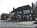
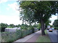
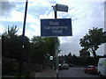
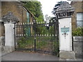
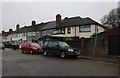
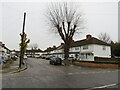
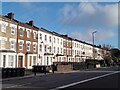
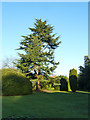

23 photos from this area
Area Information
Key information about the EN1 2LB including its size, population, and administrative classification.
- Area Type
- Postcode
- Area Size
- 8722 m²
- Population
- 1482
- Population Density
- 6106 people/km²
House Prices in EN1 2LB
24
Properties
£419,205
Average Sold Price
£154,995
Lowest Price
£710,000
Highest Price
Showing 24 properties
| Address | Type | Beds | Baths | Last Sale Price | Last Sale Date | |
|---|---|---|---|---|---|---|
| 33 Ash Grove, Enfield, EN1 2LB | Retail | 3 | 1 | £710,000 | Oct 2022 | |
| 55 Ash Grove, Enfield, EN1 2LB | Terraced | 3 | 1 | £702,000 | Sep 2022 | |
| 51 Ash Grove, Enfield, EN1 2LB | house | - | - | £710,000 | Dec 2021 | |
| 27 Ash Grove, Enfield, EN1 2LB | Bungalow | - | - | £652,750 | May 2021 | |
| 39 Ash Grove, Enfield, EN1 2LB | Bungalow | 2 | 1 | £480,000 | Feb 2020 | |
| 37 Ash Grove, Enfield, EN1 2LB | Bungalow | 2 | 1 | £520,000 | Oct 2015 | |
| 29 Ash Grove, Enfield, EN1 2LB | Bungalow | 3 | 1 | £525,000 | Feb 2014 | |
| 16 Ash Grove, Enfield, EN1 2LB | Terraced | 3 | 1 | £450,000 | Jan 2014 | |
| 47 Ash Grove, Enfield, EN1 2LB | house | - | - | £327,500 | Jan 2012 | |
| 35 Ash Grove, Enfield, EN1 2LB | Bungalow | 2 | 1 | £365,000 | May 2010 |
Page 1 of 3
Energy Efficiency in EN1 2LB
Amenities
Schools
| Rank | School | Type | Entry gender | Ages |
|---|
Explore more schools in this area
Go to Schools tabDemographics
Household Size
Family (3-5 people)
most common
Accommodation Type
Houses
most common
Tenure
83
majority
Ethnic Group
White
most common
Religion
N/A
most common
Household Composition
N/A
most common
Age
47
median
Adults (30-64 years)
most common
Household Deprivation
N/A
with no deprivation
NS-SEC
36
in Lower managerial occupations
Explore more demographic insights in this area
Go to Demographics tabPlanning
Planning Constraints
- Flood RiskPremium
- Ramsar Wetland SitesPremium
- Area of Outstanding Natural BeautyPremium
- Protected Nature ReservePremium
- Protected WoodlandPremium