Area Overview for EN1 1ET
Photos of EN1 1ET
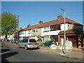
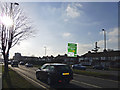
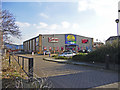
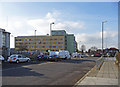
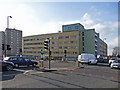
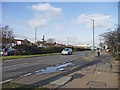
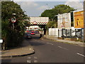
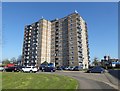
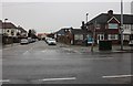
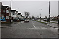
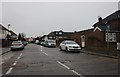
33 photos from this area
Area Information
Key information about the EN1 1ET including its size, population, and administrative classification.
- Area Type
- Postcode
- Area Size
- 3331 m²
- Population
- 1658
- Population Density
- 5219 people/km²
House Prices in EN1 1ET
12
Properties
£247,925
Average Sold Price
£73,750
Lowest Price
£415,000
Highest Price
Showing 12 properties
| Address | Type | Beds | Baths | Last Sale Price | Last Sale Date | |
|---|---|---|---|---|---|---|
| 5 Haddon Close, Enfield, EN1 1ET | Terraced | 3 | 1 | £415,000 | Jun 2025 | |
| 7 Haddon Close, Enfield, EN1 1ET | Terraced | 3 | 1 | £371,500 | Jun 2019 | |
| 9 Haddon Close, Enfield, EN1 1ET | Terraced | 3 | 1 | £360,000 | Aug 2016 | |
| 10 Haddon Close, Enfield, EN1 1ET | Terraced | 3 | 1 | £310,000 | Apr 2014 | |
| 12 Haddon Close, Enfield, EN1 1ET | house | 3 | - | £280,000 | Mar 2014 | |
| 8 Haddon Close, Enfield, EN1 1ET | house | 3 | - | £250,000 | May 2012 | |
| 2 Haddon Close, Enfield, EN1 1ET | Terraced | 3 | 1 | £225,000 | Feb 2012 | |
| 1 Haddon Close, Enfield, EN1 1ET | Terraced | - | - | £110,000 | Mar 1998 | |
| 11 Haddon Close, Enfield, EN1 1ET | Terraced | - | - | £84,000 | Nov 1996 | |
| 4 Haddon Close, Enfield, EN1 1ET | Terraced | - | - | £73,750 | Aug 1995 |
Page 1 of 2
Energy Efficiency in EN1 1ET
Amenities
Schools
| Rank | School | Type | Entry gender | Ages |
|---|
Explore more schools in this area
Go to Schools tabDemographics
Household Size
Family (3-5 people)
most common
Accommodation Type
Houses
most common
Tenure
63
majority
Ethnic Group
White
most common
Religion
N/A
most common
Household Composition
N/A
most common
Age
47
median
Adults (30-64 years)
most common
Household Deprivation
N/A
with no deprivation
NS-SEC
25
in Lower managerial occupations
Explore more demographic insights in this area
Go to Demographics tabPlanning
Planning Constraints
- Flood RiskPremium
- Ramsar Wetland SitesPremium
- Area of Outstanding Natural BeautyPremium
- Protected Nature ReservePremium
- Protected WoodlandPremium