Area Overview for N9 7PN
Photos of N9 7PN
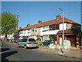
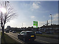
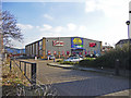
33 photos from this area
Area Information
Key information about the N9 7PN including its size, population, and administrative classification.
- Area Type
- Postcode
- Area Size
- 6892 m²
- Population
- 1658
- Population Density
- 5219 people/km²
House Prices in N9 7PN
34
Properties
£279,643
Average Sold Price
£53,000
Lowest Price
£495,000
Highest Price
Showing 34 properties
| Address | Type | Beds | Baths | Last Sale Price | Last Sale Date | |
|---|---|---|---|---|---|---|
| 158 St Edmunds Road, Edmonton, N9 7PN | Terraced | 2 | 1 | £435,000 | Jun 2023 | |
| 150 St Edmunds Road, Edmonton, N9 7PN | house | 3 | 1 | £457,000 | Dec 2022 | |
| 172 St Edmunds Road, Edmonton, N9 7PN | house | - | - | £400,000 | May 2022 | |
| 124 St Edmunds Road, Edmonton, N9 7PN | Terraced | 3 | 1 | £350,000 | Jan 2021 | |
| 144 St Edmunds Road, Edmonton, N9 7PN | Terraced | 5 | 2 | £495,000 | Mar 2020 | |
| 160 St Edmunds Road, Edmonton, N9 7PN | Terraced | 2 | 1 | £373,000 | Jun 2018 | |
| 152 St Edmunds Road, Edmonton, N9 7PN | Terraced | 2 | 1 | £347,000 | Jun 2018 | |
| 176 St Edmunds Road, Edmonton, N9 7PN | Terraced | 3 | 1 | £337,000 | Nov 2017 | |
| 168 St Edmunds Road, Edmonton, N9 7PN | Terraced | 3 | - | £345,500 | Jul 2017 | |
| 170 St Edmunds Road, Edmonton, N9 7PN | house | - | - | £260,000 | Mar 2016 |
Page 1 of 4
Energy Efficiency in N9 7PN
Amenities
Schools
| Rank | School | Type | Entry gender | Ages |
|---|
Explore more schools in this area
Go to Schools tabDemographics
Household Size
Family (3-5 people)
most common
Accommodation Type
Houses
most common
Tenure
63
majority
Ethnic Group
White
most common
Religion
N/A
most common
Household Composition
N/A
most common
Age
47
median
Adults (30-64 years)
most common
Household Deprivation
N/A
with no deprivation
NS-SEC
25
in Lower managerial occupations
Explore more demographic insights in this area
Go to Demographics tabPlanning
Planning Constraints
- Flood RiskPremium
- Ramsar Wetland SitesPremium
- Area of Outstanding Natural BeautyPremium
- Protected Nature ReservePremium
- Protected WoodlandPremium