Area Overview for E17 4LF
Photos of E17 4LF


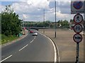
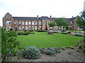
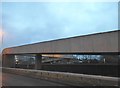
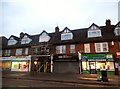
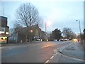


61 photos from this area
Area Information
Key information about the E17 4LF including its size, population, and administrative classification.
- Area Type
- Postcode
- Area Size
- 1.7 hectares
- Population
- 2091
- Population Density
- 5818 people/km²
House Prices in E17 4LF
70
Properties
£305,182
Average Sold Price
£85,000
Lowest Price
£780,000
Highest Price
Showing 70 properties
| Address | Type | Beds | Baths | Last Sale Price | Last Sale Date | |
|---|---|---|---|---|---|---|
| 7 Sturge Avenue, Walthamstow, E17 4LF | Flat | 2 | 2 | £465,000 | Feb 2025 | |
| 55 Sturge Avenue, Walthamstow, E17 4LF | house | 3 | 1 | £330,000 | Oct 2023 | |
| 129 Sturge Avenue, Walthamstow, E17 4LF | Terraced | 3 | 1 | £505,000 | Sep 2023 | |
| 105 Sturge Avenue, Walthamstow, E17 4LF | Terraced | 3 | 1 | £510,000 | Aug 2023 | |
| 119 Sturge Avenue, Walthamstow, E17 4LF | Terraced | 3 | 1 | £780,000 | Jul 2023 | |
| 9 Sturge Avenue, Walthamstow, E17 4LF | Retail | 2 | 2 | £555,000 | Jul 2022 | |
| 97 Sturge Avenue, Walthamstow, E17 4LF | Terraced | 3 | - | £512,000 | Feb 2022 | |
| 67 Sturge Avenue, Walthamstow, E17 4LF | Terraced | 3 | 1 | £510,052 | Dec 2021 | |
| 115 Sturge Avenue, Walthamstow, E17 4LF | Terraced | 2 | 1 | £400,000 | May 2020 | |
| 151 Sturge Avenue, Walthamstow, E17 4LF | Terraced | 3 | - | £407,500 | Mar 2020 |
Page 1 of 7
Energy Efficiency in E17 4LF
Amenities
Schools
| Rank | School | Type | Entry gender | Ages |
|---|
Explore more schools in this area
Go to Schools tabDemographics
Household Size
Family (3-5 people)
most common
Accommodation Type
Houses
most common
Tenure
53
majority
Ethnic Group
White
most common
Religion
N/A
most common
Household Composition
N/A
most common
Age
47
median
Adults (30-64 years)
most common
Household Deprivation
N/A
with no deprivation
NS-SEC
36
in Lower managerial occupations
Explore more demographic insights in this area
Go to Demographics tabPlanning
Planning Constraints
- Flood RiskPremium
- Ramsar Wetland SitesPremium
- Area of Outstanding Natural BeautyPremium
- Protected Nature ReservePremium
- Protected WoodlandPremium