Area Overview for E17 4LE
Photos of E17 4LE


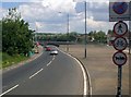
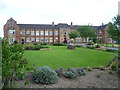
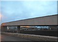
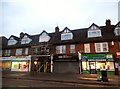
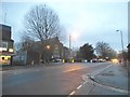


61 photos from this area
Area Information
Key information about the E17 4LE including its size, population, and administrative classification.
- Area Type
- Postcode
- Area Size
- 4393 m²
- Population
- 2091
- Population Density
- 5818 people/km²
House Prices in E17 4LE
22
Properties
£320,624
Average Sold Price
£54,000
Lowest Price
£745,000
Highest Price
Showing 22 properties
| Address | Type | Beds | Baths | Last Sale Price | Last Sale Date | |
|---|---|---|---|---|---|---|
| 156 Sturge Avenue, Walthamstow, E17 4LE | Terraced | 4 | 2 | £745,000 | Nov 2025 | |
| 140 Sturge Avenue, Walthamstow, E17 4LE | Terraced | 2 | 1 | £460,000 | Dec 2024 | |
| 142 Sturge Avenue, Walthamstow, E17 4LE | house | - | - | £485,000 | Aug 2022 | |
| 134 Sturge Avenue, Walthamstow, E17 4LE | house | 2 | 1 | £400,000 | Aug 2016 | |
| 154 Sturge Avenue, Walthamstow, E17 4LE | house | - | - | £210,000 | Jan 2013 | |
| 144 Sturge Avenue, Walthamstow, E17 4LE | house | - | - | £111,000 | Oct 2001 | |
| 146 Sturge Avenue, Walthamstow, E17 4LE | house | - | - | £99,995 | Apr 2000 | |
| 114 Sturge Avenue, Walthamstow, E17 4LE | Terraced | 2 | - | £54,000 | Mar 1996 | |
| 116 Sturge Avenue, Walthamstow, E17 4LE | Terraced | 2 | 2 | - | - | |
| 126 Sturge Avenue, Walthamstow, E17 4LE | Terraced | - | - | - | - |
Page 1 of 3
Energy Efficiency in E17 4LE
Amenities
Schools
| Rank | School | Type | Entry gender | Ages |
|---|
Explore more schools in this area
Go to Schools tabDemographics
Household Size
Family (3-5 people)
most common
Accommodation Type
Houses
most common
Tenure
53
majority
Ethnic Group
White
most common
Religion
N/A
most common
Household Composition
N/A
most common
Age
47
median
Adults (30-64 years)
most common
Household Deprivation
N/A
with no deprivation
NS-SEC
36
in Lower managerial occupations
Explore more demographic insights in this area
Go to Demographics tabPlanning
Planning Constraints
- Flood RiskPremium
- Ramsar Wetland SitesPremium
- Area of Outstanding Natural BeautyPremium
- Protected Nature ReservePremium
- Protected WoodlandPremium