Area Overview for E17 4JH
Photos of E17 4JH
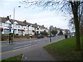
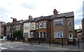
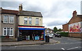
27 photos from this area
Area Information
Key information about the E17 4JH including its size, population, and administrative classification.
- Area Type
- Postcode
- Area Size
- 1.1 hectares
- Population
- 2091
- Population Density
- 5818 people/km²
House Prices in E17 4JH
64
Properties
£309,890
Average Sold Price
£58,000
Lowest Price
£875,000
Highest Price
Showing 64 properties
| Address | Type | Beds | Baths | Last Sale Price | Last Sale Date | |
|---|---|---|---|---|---|---|
| 145 St Johns Road, Walthamstow, E17 4JH | Terraced | 4 | 2 | £875,000 | Aug 2023 | |
| 105 St Johns Road, Walthamstow, E17 4JH | Retail | 4 | 2 | £706,500 | Sep 2022 | |
| 143 St Johns Road, Walthamstow, E17 4JH | Retail | 2 | 1 | £535,000 | Jul 2022 | |
| 127 St Johns Road, Walthamstow, E17 4JH | Terraced | 2 | - | £610,000 | Dec 2020 | |
| 139 ST JOHNS ROAD, Walthamstow, E17 4JH | Flat | 2 | 1 | £410,050 | Nov 2020 | |
| 89 St Johns Road, Walthamstow, E17 4JH | Terraced | 2 | - | £500,000 | Sep 2019 | |
| 151 St Johns Road, Walthamstow, E17 4JH | Flat | 2 | 1 | £395,000 | Sep 2016 | |
| 81 St Johns Road, Walthamstow, E17 4JH | Terraced | 4 | 1 | £567,000 | Jan 2016 | |
| 133 St Johns Road, Walthamstow, E17 4JH | house | - | - | £450,000 | Mar 2014 | |
| 161 St Johns Road, Walthamstow, E17 4JH | house | - | - | £367,000 | Jan 2014 |
Page 1 of 7
Energy Efficiency in E17 4JH
Amenities
Schools
| Rank | School | Type | Entry gender | Ages |
|---|
Explore more schools in this area
Go to Schools tabDemographics
Household Size
Family (3-5 people)
most common
Accommodation Type
Houses
most common
Tenure
53
majority
Ethnic Group
White
most common
Religion
N/A
most common
Household Composition
N/A
most common
Age
47
median
Adults (30-64 years)
most common
Household Deprivation
N/A
with no deprivation
NS-SEC
36
in Lower managerial occupations
Explore more demographic insights in this area
Go to Demographics tabPlanning
Planning Constraints
- Flood RiskPremium
- Ramsar Wetland SitesPremium
- Area of Outstanding Natural BeautyPremium
- Protected Nature ReservePremium
- Protected WoodlandPremium