Area Overview for E14 0ER
Photos of E14 0ER
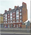
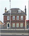
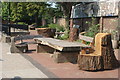
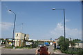
99 photos from this area
Area Information
Key information about the E14 0ER including its size, population, and administrative classification.
- Area Type
- Postcode
- Area Size
- 2137 m²
- Population
- 2721
- Population Density
- 13639 people/km²
House Prices in E14 0ER
8
Properties
£445,000
Average Sold Price
£240,000
Lowest Price
£700,000
Highest Price
Showing 8 properties
| Address | Type | Beds | Baths | Last Sale Price | Last Sale Date | |
|---|---|---|---|---|---|---|
| 19 Bullivant Street, London, E14 0ER | house | 4 | - | £700,000 | Aug 2021 | |
| 18 Bullivant Street, London, E14 0ER | house | 4 | - | £675,000 | Dec 2020 | |
| 16 Bullivant Street, London, E14 0ER | house | - | - | £610,000 | Jul 2019 | |
| 17 Bullivant Street, London, E14 0ER | house | 1 | 1 | £360,000 | Jan 2008 | |
| 14 Bullivant Street, London, E14 0ER | house | - | - | £249,000 | May 2005 | |
| 20 Bullivant Street, London, E14 0ER | house | 3 | - | £240,000 | Sep 2003 | |
| 15 Bullivant Street, London, E14 0ER | house | - | - | £281,000 | Dec 2002 | |
| St Matthias Centre, Bullivant Street, London, E14 0ER | commercial | - | - | - | - |
Energy Efficiency in E14 0ER
Amenities
Schools
| Rank | School | Type | Entry gender | Ages |
|---|
Explore more schools in this area
Go to Schools tabDemographics
Household Size
Two person
most common
Accommodation Type
Flats
most common
Tenure
24
majority
Ethnic Group
asian_total
most common
Religion
N/A
most common
Household Composition
N/A
most common
Age
22
median
Adults (30-64 years)
most common
Household Deprivation
N/A
with no deprivation
NS-SEC
41
in Lower managerial occupations
Explore more demographic insights in this area
Go to Demographics tabPlanning
Planning Constraints
- Flood RiskPremium
- Ramsar Wetland SitesPremium
- Area of Outstanding Natural BeautyPremium
- Protected Nature ReservePremium
- Protected WoodlandPremium