Area Overview for E14 0EG
Photos of E14 0EG
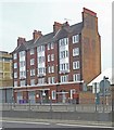
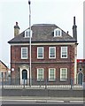
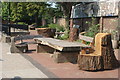
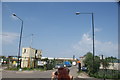
99 photos from this area
Area Information
Key information about the E14 0EG including its size, population, and administrative classification.
- Area Type
- Postcode
- Area Size
- 7229 m²
- Population
- 2640
- Population Density
- 22185 people/km²
House Prices in E14 0EG
59
Properties
£113,250
Average Sold Price
£81,500
Lowest Price
£145,000
Highest Price
Showing 59 properties
| Address | Type | Beds | Baths | Last Sale Price | Last Sale Date | |
|---|---|---|---|---|---|---|
| 251B East India Dock Road, London, E14 0EG | Maisonette | 2 | 2 | £145,000 | Mar 2002 | |
| 241A East India Dock Road, London, E14 0EG | Flat | - | - | £81,500 | Jul 1999 | |
| Flat 2, 235B East India Dock Road, London, E14 0EG | Flat | 1 | - | - | - | |
| 267A EAST INDIA DOCK ROAD, London, E14 0EG | Flat | 1 | 1 | - | - | |
| Tmg, 263 East India Dock Road, London, E14 0EG | restaurant_cafe | - | - | - | - | |
| 261D East India Dock Road, London, E14 0EG | Flat | - | - | - | - | |
| 231A East India Dock Road, London, E14 0EG | Flat | 1 | 1 | - | - | |
| 265D East India Dock Road, London, E14 0EG | Flat | 2 | 1 | - | - | |
| 261B East India Dock Road, London, E14 0EG | Flat | - | - | - | - | |
| 265C East India Dock Road, London, E14 0EG | Flat | - | - | - | - |
Page 1 of 6
Energy Efficiency in E14 0EG
Amenities
Schools
| Rank | School | Type | Entry gender | Ages |
|---|
Explore more schools in this area
Go to Schools tabDemographics
Household Size
Family (3-5 people)
most common
Accommodation Type
Flats
most common
Tenure
17
majority
Ethnic Group
asian_total
most common
Religion
N/A
most common
Household Composition
N/A
most common
Age
22
median
Adults (30-64 years)
most common
Household Deprivation
N/A
with no deprivation
NS-SEC
26
in Lower managerial occupations
Explore more demographic insights in this area
Go to Demographics tabPlanning
Planning Constraints
- Flood RiskPremium
- Ramsar Wetland SitesPremium
- Area of Outstanding Natural BeautyPremium
- Protected Nature ReservePremium
- Protected WoodlandPremium