Area Overview for DA7 5SG
Photos of DA7 5SG
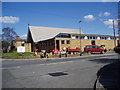
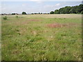
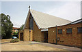
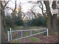
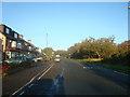
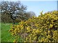
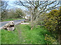
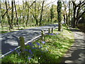
59 photos from this area
Area Information
Key information about the DA7 5SG including its size, population, and administrative classification.
- Area Type
- Postcode
- Area Size
- 1.4 hectares
- Population
- 1495
- Population Density
- 5669 people/km²
House Prices in DA7 5SG
28
Properties
£371,050
Average Sold Price
£137,500
Lowest Price
£580,000
Highest Price
Showing 28 properties
| Address | Type | Beds | Baths | Last Sale Price | Last Sale Date | |
|---|---|---|---|---|---|---|
| 48 Canberra Road, Bexleyheath, DA7 5SG | Detached | 3 | 2 | £475,000 | Jul 2025 | |
| 28 Canberra Road, Bexleyheath, DA7 5SG | Semi-detached | 3 | 1 | £415,000 | Jul 2024 | |
| 6 Canberra Road, Bexleyheath, DA7 5SG | Semi-detached | 3 | 2 | £532,000 | Sep 2023 | |
| 34 Canberra Road, Bexleyheath, DA7 5SG | house | - | - | £560,000 | Dec 2020 | |
| 2 Canberra Road, Bexleyheath, DA7 5SG | Semi-detached | 5 | 2 | £580,000 | Oct 2020 | |
| 10 Canberra Road, Bexleyheath, DA7 5SG | Semi-detached | 4 | 2 | £507,000 | Mar 2019 | |
| 46 Canberra Road, Bexleyheath, DA7 5SG | Semi-detached | 3 | 1 | £445,000 | Feb 2019 | |
| 24 Canberra Road, Bexleyheath, DA7 5SG | Semi-detached | 4 | 2 | £505,000 | Aug 2018 | |
| 40 Canberra Road, Bexleyheath, DA7 5SG | house | - | - | £403,000 | Jan 2016 | |
| 14 Canberra Road, Bexleyheath, DA7 5SG | Semi-detached | 3 | - | £325,000 | Oct 2014 |
Page 1 of 3
Energy Efficiency in DA7 5SG
Amenities
Schools
| Rank | School | Type | Entry gender | Ages |
|---|
Explore more schools in this area
Go to Schools tabDemographics
Household Size
Family (3-5 people)
most common
Accommodation Type
Houses
most common
Tenure
90
majority
Ethnic Group
White
most common
Religion
N/A
most common
Household Composition
N/A
most common
Age
47
median
Adults (30-64 years)
most common
Household Deprivation
N/A
with no deprivation
NS-SEC
31
in Lower managerial occupations
Explore more demographic insights in this area
Go to Demographics tabPlanning
Planning Constraints
- Flood RiskPremium
- Ramsar Wetland SitesPremium
- Area of Outstanding Natural BeautyPremium
- Protected Nature ReservePremium
- Protected WoodlandPremium