Area Overview for DA14 6LT
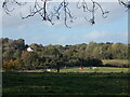
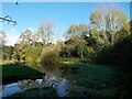
Photos of DA14 6LT


Area Information
Living in DA14 6LT means residing within a compact residential cluster covering just 6.3 hectares in the London Borough of Bexley. This postcode serves a specific community of 1,902 people, creating a tightly knit environment where neighbours are often familiar faces. The area is located 11.3 miles south-east of Charing Cross, forming part of the historic Sidcup Ward. This district evolved from a tiny Anglo-Saxon hamlet known as 'set copp' into a typical 1930s suburban district after being formed in 2002 for local elections. Today, the neighbourhood retains the character of interwar development built on former rural land, featuring housing estates like Penhill Park and Albany Park. Residing in DA14 6LT offers proximity to key local landmarks such as the former Black Horse pub on the high street and St John's Church, which dates back to 1901. The area balances thequietude of a suburban setting with the convenience of established transport links and local services just beyond the immediate boundaries. You can expect a residential atmosphere defined by its history, from the records of King Henry III to the construction of Sidcup Manor House and the 1912 cemetery, all contributing to a distinct sense of place.
- Area Type
- Postcode
- Area Size
- 6.3 hectares
- Population
- 1902
- Population Density
- 2130 people/km²
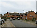
The property market in DA14 6LT is dominated by flats, which represent the predominant accommodation type for residents. With only 41 per cent of residents owning their homes, a substantial portion of the housing stock is let. This figure suggests a dynamic mix of owner-occupiers and private tenants, typical of high-density postcode areas. Given the small total area size of 6.3 hectares, individual plot sizes are likely very limited, reinforcing the shift towards flat-based living. Buyers looking at this postcode should expect a market characterised by shared entry buildings or larger blocks rather than traditional Georgian terrace homes or sprawling estates. The history of the area, including the development of estates like Penhill Park by New Ideal Homesteads, explains the prevalence of these apartment-style properties. For anyone seeking a home in DA14 6LT, the focus must be on the quality of the building and the location within the cluster, as larger garden plots are not a feature of this specific demographic and geographic footprint. The market reflects a practical approach to housing in South-East London, prioritising efficiency and proximity to transport hubs over traditional suburban space.
House Prices in DA14 6LT
Showing 15 properties
| Address | Type | Beds | Baths | Last Sale Price | Last Sale Date | |
|---|---|---|---|---|---|---|
| 1, Frognal Flats, Frognal Avenue, Sidcup, DA14 6LT | Flat | - | - | - | - | |
| 2, Frognal Flats, Frognal Avenue, Sidcup, DA14 6LT | Flat | - | - | - | - | |
| 5, Frognal Flats, Frognal Avenue, Sidcup, DA14 6LT | Detached | 3 | 2 | - | - | |
| 7, Frognal Flats, Frognal Avenue, Sidcup, DA14 6LT | Flat | - | - | - | - | |
| 3, Frognal Flats, Frognal Avenue, Sidcup, DA14 6LT | Flat | - | - | - | - | |
| 4, Frognal Flats, Frognal Avenue, Sidcup, DA14 6LT | Flat | - | - | - | - | |
| 6, Frognal Flats, Frognal Avenue, Sidcup, DA14 6LT | Flat | - | - | - | - | |
| 8, Frognal Flats, Frognal Avenue, Sidcup, DA14 6LT | Flat | - | - | - | - | |
| League Of Friends Sweetshop, Queen Marys Hospital, Frognal Avenue, Sidcup, DA14 6LT | commercial | - | - | - | - | |
| League Of Friends Refreshments, Queen Marys Hospital, Frognal Avenue, Sidcup, DA14 6LT | commercial | - | - | - | - |
Energy Efficiency in DA14 6LT
Living in DA14 6LT provides convenient access to a variety of amenities within practical reach, catering to daily shopping and leisure needs. For retail, you have five major options nearby, including Morrisons Sidcup, M&S Perry Street BP, and Waitrose Little. These stores ensure you can pick up groceries and essentials without travelling far. Transport links are equally robust, with five rail connections available via Sidcup Station, Albany Park Station, and St Mary Cray Station. You can also access three ferry terminals, including Woolwich Arsenal Pier and Barrier Gardens Pier, should you wish to travel across the River Thames. Furthermore, two metro stops, King George V and Elverson Road, are close by, offering additional local travel options. The area's lifestyle is defined by this mix of essential services and transport infrastructure. After a day working in Central London, you can return home knowing that supermarkets and train stations are just minutes away. The historic character of Sidcup, with its 1930s housing and landmarks like The Hollies, adds a layer of charm to this functional suburban environment.
Amenities
Schools
Schooles near DA14 6LT include two specific institutions that serve the local children's community. St Mary and St Joseph's Catholic School operates as a primary school within the catchment area. Additionally, St Luke's Catholic Sixth Form College is also listed as a primary school in the immediate vicinity. This combination of Catholic primary education options provides clear pathways for young families residing in the postcode. While there is a range of education types present, the focus here is firmly on primary-level instruction offered by these established religious institutions. Families living in DA14 6LT will find these schools within practical reach, allowing for easier school runs compared to distant academies. The presence of both options offers parents a choice within the same faith and age bracket, which can simplify decision-making for local households. Any child attending schools near DA14 6LT benefits from this concentrated provision of Catholic primary education, supported by the community's historical investment in schooling from the late 19th century onwards.
| Rank | School | Type | Entry gender | Ages |
|---|
Explore more schools in this area
Go to Schools tabDemographics
The community profile in DA14 6LT reflects a mature population centred around adulthood. The median age stands at 47 years, with the most common age range falling between 30 and 64 years. This demographic skew suggests an area favoured by established households rather than young families or empty nesters. Home ownership levels sit at 41 per cent, indicating that a significant minority of residents still rent their accommodation. The primary accommodation type available in this postcode is flats, distinguishing it from areas dominated by detached or semi-detached houses. Ethnic diversity is predominantly White, mirroring the broader demographic trends of South-East London. For those considering moving to DA14 6LT, the high proportion of adults in the workforce implies a stable, established community. The concentration of flats combined with the age profile creates a specific lifestyle where residents often value low-maintenance living and access to local amenities over extensive garden space. This data paints a picture of a settled area where the daily rhythm is dictated by commuters and professionals managing households in close proximity to one another.
Household Size
Accommodation Type
Tenure
Ethnic Group
Religion
Household Composition
Age
Household Deprivation
NS-SEC
Explore more demographic insights in this area
Go to Demographics tabPlanning
Planning Constraints
- Flood RiskPremium
- Ramsar Wetland SitesPremium
- Area of Outstanding Natural BeautyPremium
- Protected Nature ReservePremium
- Protected WoodlandPremium