Area Overview for DA14 6BS
Photos of DA14 6BS
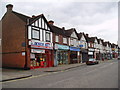
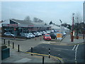
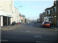
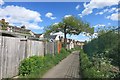
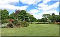
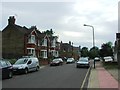
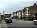
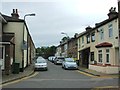
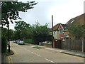
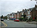
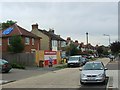
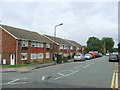
76 photos from this area
Area Information
Key information about the DA14 6BS including its size, population, and administrative classification.
- Area Type
- Postcode
- Area Size
- 13.3 hectares
- Population
- 1902
- Population Density
- 2130 people/km²
House Prices in DA14 6BS
26
Properties
£762,179
Average Sold Price
£215,000
Lowest Price
£1,750,000
Highest Price
Showing 26 properties
| Address | Type | Beds | Baths | Last Sale Price | Last Sale Date | |
|---|---|---|---|---|---|---|
| Thyme Cottage, 1 The Green, Sidcup, DA14 6BS | Detached | 3 | 1 | £395,000 | Aug 2023 | |
| Ringwood, The Green, Sidcup, DA14 6BS | Detached | 6 | 2 | £870,000 | Nov 2020 | |
| Place Cottage, The Green, Sidcup, DA14 6BS | Detached | 4 | 2 | £975,000 | Mar 2020 | |
| 5 The Green, Sidcup, DA14 6BS | Detached | 3 | 2 | £1,292,500 | Aug 2017 | |
| St Denys, The Green, Sidcup, DA14 6BS | Semi-detached | 3 | 1 | £510,000 | Oct 2016 | |
| 7 The Green, Sidcup, DA14 6BS | Detached | 5 | - | £1,267,000 | Jun 2015 | |
| 8 The Green, Sidcup, DA14 6BS | Detached | 5 | - | £1,120,000 | Feb 2015 | |
| Doone Cottage, The Green, Sidcup, DA14 6BS | Detached | 3 | 1 | £450,000 | Jun 2014 | |
| Bramble Cottage, The Green, Sidcup, DA14 6BS | Terraced | 3 | - | £355,000 | Jul 2011 | |
| St Johns Lodge, The Green, Sidcup, DA14 6BS | house | - | - | £326,000 | Mar 2008 |
Page 1 of 3
Energy Efficiency in DA14 6BS
Amenities
Schools
| Rank | School | Type | Entry gender | Ages |
|---|
Explore more schools in this area
Go to Schools tabDemographics
Household Size
One person
most common
Accommodation Type
Flats
most common
Tenure
41
majority
Ethnic Group
White
most common
Religion
N/A
most common
Household Composition
N/A
most common
Age
47
median
Adults (30-64 years)
most common
Household Deprivation
N/A
with no deprivation
NS-SEC
37
in Lower managerial occupations
Explore more demographic insights in this area
Go to Demographics tabPlanning
Planning Constraints
- Flood RiskPremium
- Ramsar Wetland SitesPremium
- Area of Outstanding Natural BeautyPremium
- Protected Nature ReservePremium
- Protected WoodlandPremium