Area Overview for DA14 6LE
Photos of DA14 6LE


Area Information
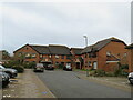
DA14 6LE is a small residential postcode in the London Borough of Bexley, encompassing a suburban district with a population of 1,902. Situated 11.3 miles south-east of Charing Cross, it reflects the character of a 1930s London suburb, with housing estates like Penhill Park and Albany Park dominating the landscape. The area has a mature demographic, with a median age of 47 and most residents falling in the 30-64 age range. Daily life here balances suburban tranquillity with easy access to transport networks, including three rail stations within proximity. Sidcup’s history as a former hamlet evolving into a commuter suburb is evident in its layout, with a mix of interwar housing and modern amenities. The postcode’s compact size means it is ideal for those seeking a quieter, family-oriented environment without sacrificing connectivity to London’s central hubs.
- Area Type
- Postcode
- Area Size
- Not available
- Population
- 1902
- Population Density
- 2130 people/km²
DA14 6LE’s property market is characterised by a 41% home ownership rate, indicating a balance between owner-occupied and rental properties. The predominant accommodation type is flats, a legacy of 1930s suburban development and post-war housing schemes. Given the area’s small size, the housing stock is limited, with most properties concentrated in estates like Penhill Park and Albany Park. This suggests a niche market where buyers may need to consider nearby areas for more options. The flat-dominated landscape may appeal to those seeking manageable, low-maintenance homes, though the limited supply could affect competition. For buyers, the area’s compact nature means proximity to transport links and amenities is a key consideration.
House Prices in DA14 6LE
No properties found in this postcode.
Energy Efficiency in DA14 6LE
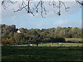
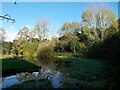
DA14 6LE’s residents have access to a range of amenities within practical reach. Retail options include M&S Perry Street BP, Morrisons Sidcup, and Waitrose Little, catering to everyday shopping needs. The area’s rail stations connect to London’s transport network, while ferry piers like Woolwich Arsenal Pier offer alternative travel routes. The King George V metro station adds to the local connectivity. The suburban character of DA14 6LE, with its 1930s housing estates, complements these amenities, creating a balance between convenience and a quieter lifestyle. Parks and green spaces, such as Footscray Meadows, provide recreational opportunities, enhancing the area’s appeal for families and commuters alike.
Amenities
Schools
Nearby DA14 6LE are two primary schools: St Mary and St Joseph’s Catholic School and St Luke’s Catholic Sixth Form College. Both institutions serve the local community, offering primary education and, in the case of St Luke’s, a sixth-form option. The presence of a sixth-form college suggests families have access to both primary and secondary education within the area, reducing the need for long commutes. However, the data does not include Ofsted ratings, so prospective parents should verify current performance independently. The mix of school types supports a range of educational needs, though further details on curriculum or facilities are not provided.
| Rank | School | Type | Entry gender | Ages |
|---|
Explore more schools in this area
Go to Schools tabDemographics
The community in DA14 6LE is predominantly composed of adults aged 30-64, with a median age of 47. Home ownership rates stand at 41%, indicating a mix of owner-occupied properties and rental homes. The accommodation type is largely flats, reflecting the area’s post-war housing developments. The predominant ethnic group is White, though specific diversity data is not provided. This age profile suggests a stable, middle-class population, likely with established careers and families. The 41% home ownership figure implies a significant proportion of residents may be renting, which could influence local property dynamics. The absence of detailed deprivation data means quality of life assessments must rely on other metrics, such as transport access and amenities.
Household Size
Accommodation Type
Tenure
Ethnic Group
Religion
Household Composition
Age
Household Deprivation
NS-SEC
Explore more demographic insights in this area
Go to Demographics tabPlanning
Planning Constraints
- Flood RiskPremium
- Ramsar Wetland SitesPremium
- Area of Outstanding Natural BeautyPremium
- Protected Nature ReservePremium
- Protected WoodlandPremium