Area Overview for BR7 6BS
Photos of BR7 6BS
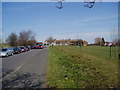
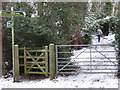
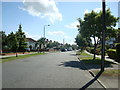
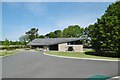
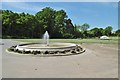

41 photos from this area
Area Information
Key information about the BR7 6BS including its size, population, and administrative classification.
- Area Type
- Postcode
- Area Size
- 8.0 hectares
- Population
- 1670
- Population Density
- 4738 people/km²
House Prices in BR7 6BS
41
Properties
£372,263
Average Sold Price
£82,500
Lowest Price
£795,000
Highest Price
Showing 41 properties
| Address | Type | Beds | Baths | Last Sale Price | Last Sale Date | |
|---|---|---|---|---|---|---|
| 96 Woodside Avenue, Chislehurst, BR7 6BS | Terraced | 3 | 1 | £605,000 | Feb 2024 | |
| 90 Woodside Avenue, Chislehurst, BR7 6BS | house | 3 | - | £795,000 | Oct 2022 | |
| 152 Woodside Avenue, Chislehurst, BR7 6BS | house | - | - | £750,000 | Mar 2022 | |
| 158 Woodside Avenue, Chislehurst, BR7 6BS | house | - | - | £720,000 | Jun 2021 | |
| 126 Woodside Avenue, Chislehurst, BR7 6BS | Semi-detached | 4 | - | £602,064 | Sep 2018 | |
| 136 Woodside Avenue, Chislehurst, BR7 6BS | Semi-detached | 4 | 3 | £540,000 | Feb 2015 | |
| 166 Woodside Avenue, Chislehurst, BR7 6BS | Semi-detached | 3 | 1 | £460,000 | Jan 2015 | |
| 108 Woodside Avenue, Chislehurst, BR7 6BS | Terraced | 3 | - | £348,000 | Apr 2013 | |
| 116 Woodside Avenue, Chislehurst, BR7 6BS | Terraced | - | - | £295,000 | Jan 2013 | |
| 156 Woodside Avenue, Chislehurst, BR7 6BS | Terraced | 5 | - | £353,000 | Dec 2010 |
Page 1 of 5
Energy Efficiency in BR7 6BS
Amenities
Schools
| Rank | School | Type | Entry gender | Ages |
|---|
Explore more schools in this area
Go to Schools tabDemographics
Household Size
Family (3-5 people)
most common
Accommodation Type
Houses
most common
Tenure
76
majority
Ethnic Group
White
most common
Religion
N/A
most common
Household Composition
N/A
most common
Age
47
median
Adults (30-64 years)
most common
Household Deprivation
N/A
with no deprivation
NS-SEC
49
in Lower managerial occupations
Explore more demographic insights in this area
Go to Demographics tabPlanning
Planning Constraints
- Flood RiskPremium
- Ramsar Wetland SitesPremium
- Area of Outstanding Natural BeautyPremium
- Protected Nature ReservePremium
- Protected WoodlandPremium