Area Overview for BR7 6BT
Photos of BR7 6BT
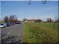
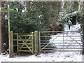
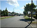
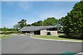
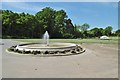

41 photos from this area
Area Information
Key information about the BR7 6BT including its size, population, and administrative classification.
- Area Type
- Postcode
- Area Size
- 9842 m²
- Population
- 1670
- Population Density
- 4738 people/km²
House Prices in BR7 6BT
27
Properties
£342,218
Average Sold Price
£80,000
Lowest Price
£890,000
Highest Price
Showing 27 properties
| Address | Type | Beds | Baths | Last Sale Price | Last Sale Date | |
|---|---|---|---|---|---|---|
| 97 Woodside Avenue, Chislehurst, BR7 6BT | Semi-detached | 4 | 2 | £890,000 | Oct 2023 | |
| 105 Woodside Avenue, Chislehurst, BR7 6BT | house | - | - | £777,000 | Nov 2022 | |
| 75 Woodside Avenue, Chislehurst, BR7 6BT | Semi-detached | 3 | 1 | £475,000 | May 2019 | |
| 63 Woodside Avenue, Chislehurst, BR7 6BT | Terraced | 3 | 2 | £590,000 | Mar 2019 | |
| 81 Woodside Avenue, Chislehurst, BR7 6BT | house | - | - | £550,000 | Aug 2018 | |
| 109 Woodside Avenue, Chislehurst, BR7 6BT | Semi-detached | 3 | 1 | £412,500 | Mar 2015 | |
| 107 Woodside Avenue, Chislehurst, BR7 6BT | Semi-detached | 3 | - | £410,000 | Jul 2014 | |
| 93 Woodside Avenue, Chislehurst, BR7 6BT | house | - | - | £325,000 | Sep 2010 | |
| 99 Woodside Avenue, Chislehurst, BR7 6BT | house | - | - | £309,950 | Sep 2009 | |
| 85 Woodside Avenue, Chislehurst, BR7 6BT | Terraced | - | - | £318,000 | Apr 2008 |
Page 1 of 3
Energy Efficiency in BR7 6BT
Amenities
Schools
| Rank | School | Type | Entry gender | Ages |
|---|
Explore more schools in this area
Go to Schools tabDemographics
Household Size
Family (3-5 people)
most common
Accommodation Type
Houses
most common
Tenure
76
majority
Ethnic Group
White
most common
Religion
N/A
most common
Household Composition
N/A
most common
Age
47
median
Adults (30-64 years)
most common
Household Deprivation
N/A
with no deprivation
NS-SEC
49
in Lower managerial occupations
Explore more demographic insights in this area
Go to Demographics tabPlanning
Planning Constraints
- Flood RiskPremium
- Ramsar Wetland SitesPremium
- Area of Outstanding Natural BeautyPremium
- Protected Nature ReservePremium
- Protected WoodlandPremium