Area Overview for BR1 2SE
Photos of BR1 2SE
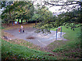
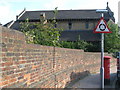
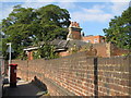
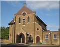
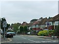
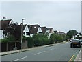
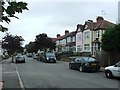
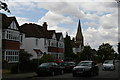
53 photos from this area
Area Information
Key information about the BR1 2SE including its size, population, and administrative classification.
- Area Type
- Postcode
- Area Size
- 1.0 hectares
- Population
- 1828
- Population Density
- 5199 people/km²
House Prices in BR1 2SE
19
Properties
£507,200
Average Sold Price
£108,000
Lowest Price
£975,000
Highest Price
Showing 19 properties
| Address | Type | Beds | Baths | Last Sale Price | Last Sale Date | |
|---|---|---|---|---|---|---|
| 88 Nightingale Lane, Bromley, BR1 2SE | house | 3 | 1 | £770,000 | Jun 2025 | |
| 84 Nightingale Lane, Bromley, BR1 2SE | Detached | 4 | - | £975,000 | Sep 2021 | |
| 68 Nightingale Lane, Bromley, BR1 2SE | Land | - | - | £535,000 | Jun 2021 | |
| 98 Nightingale Lane, Bromley, BR1 2SE | Semi-detached | 4 | 1 | £950,000 | Jun 2021 | |
| 82 Nightingale Lane, Bromley, BR1 2SE | Terraced | 5 | 2 | £645,000 | Jul 2016 | |
| 94 Nightingale Lane, Bromley, BR1 2SE | Semi-detached | 4 | 2 | £695,000 | Sep 2014 | |
| 66 Nightingale Lane, Bromley, BR1 2SE | Terraced | 4 | - | £500,000 | Jul 2014 | |
| 100 Nightingale Lane, Bromley, BR1 2SE | Semi-detached | 4 | 1 | £460,000 | May 2010 | |
| 92 Nightingale Lane, Bromley, BR1 2SE | Semi-detached | 4 | 1 | £455,000 | Feb 2010 | |
| 90 Nightingale Lane, Bromley, BR1 2SE | house | - | - | £380,000 | Jan 2010 |
Page 1 of 2
Energy Efficiency in BR1 2SE
Amenities
Schools
| Rank | School | Type | Entry gender | Ages |
|---|
Explore more schools in this area
Go to Schools tabDemographics
Household Size
One person
most common
Accommodation Type
Flats
most common
Tenure
67
majority
Ethnic Group
White
most common
Religion
N/A
most common
Household Composition
N/A
most common
Age
47
median
Adults (30-64 years)
most common
Household Deprivation
N/A
with no deprivation
NS-SEC
50
in Lower managerial occupations
Explore more demographic insights in this area
Go to Demographics tabPlanning
Planning Constraints
- Flood RiskPremium
- Ramsar Wetland SitesPremium
- Area of Outstanding Natural BeautyPremium
- Protected Nature ReservePremium
- Protected WoodlandPremium