Area Overview for BR1 2PZ
Photos of BR1 2PZ
Area Information
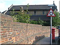
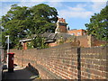
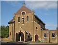
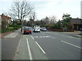
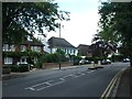
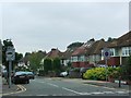
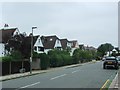
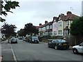
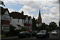
BR1 2PZ is a compact postcode area in the London Borough of Bromley, blending residential and suburban character within a small geographical footprint of 2,827 square metres. Home to 1,541 residents, it is densely populated at 545,194 people per square kilometre, reflecting its small, tightly knit nature. The area sits at the intersection of Bickley and Sundridge, historically rooted in rural development from the 1850s, with Bickley railway station opening in 1858 as a catalyst for growth. Today, it is a mature community, with a median age of 47 and a majority of residents aged 30–64. The area’s wealth is evident in its high home ownership rate (81%) and prevalence of detached housing. Its proximity to Bromley, Chislehurst, and Petts Wood offers a mix of suburban tranquillity and easy access to central London’s rail networks. For buyers, BR1 2PZ represents a stable, low-risk environment with a focus on family-oriented living, supported by nearby schools, parks, and transport links.
- Area Type
- Postcode
- Area Size
- 2827 m²
- Population
- Not available
- Population Density
- Not available
The property market in BR1 2PZ is dominated by owner-occupied detached homes, with 81% of residents in private ownership. This contrasts with areas where rental markets dominate, suggesting a stable, long-term buyer demographic. The prevalence of detached housing reflects the area’s suburban character and historical development as a residential hub. Given the postcode’s small size and high population density, the housing stock is likely limited to a small number of properties, making it a niche market for buyers seeking established homes in a low-risk environment. The lack of high-rise or multi-unit developments indicates a focus on family-friendly, spacious living. For buyers, this means limited availability but potentially strong capital retention, as the area’s safety, transport links, and amenities align with demand for secure, mature neighbourhoods.
House Prices in BR1 2PZ
Showing 2 properties
| Address | Type | Beds | Baths | Last Sale Price | Last Sale Date | |
|---|---|---|---|---|---|---|
| Cheshire Homes, 32 Sundridge Avenue, Bromley, BR1 2PZ | Retirement | - | - | - | - | |
| Top Floor Flat, Cheshire Homes, 32 Sundridge Avenue, Bromley, BR1 2PZ | Flat | - | - | - | - |
Energy Efficiency in BR1 2PZ
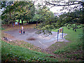
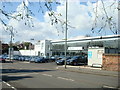
Daily life in BR1 2PZ is enriched by a range of amenities within easy reach. Retail options include major stores like M&S Widmore Bromley BP and Tesco Bromley, ensuring convenience for shopping and daily needs. The area’s transport network connects residents to leisure and cultural hubs, with ferry piers such as Greenwich Pier offering access to London’s riverside attractions. Nearby parks, including Jubilee Country Park and Scadbury Park Nature Reserve, provide green spaces for recreation, while the London LOOP cycle routes cater to active commuters. The proximity to historical sites like Sundridge Park Manor adds a layer of heritage to the area. This blend of retail, transport, and natural amenities creates a lifestyle that balances suburban comfort with urban accessibility.
Amenities
Schools
BR1 2PZ is served by Scotts Park Primary School, which holds a ‘good’ Ofsted rating, and Breaside Preparatory School, an independent institution with an ‘outstanding’ rating. The presence of both state and independent schools provides families with options tailored to different educational preferences and budgets. Scotts Park Primary School, listed twice in the data, likely serves the local primary age group, while Breaside caters to younger children in a private setting. The high rating at Breaside suggests access to high-quality early education, though its independent status may limit availability for non-residents. For families prioritising academic standards, the mix of school types offers flexibility, though the area’s small size means competition for places could be keen. The proximity of these schools to BR1 2PZ reinforces the area’s appeal as a family-friendly location.
| Rank | School | Type | Entry gender | Ages |
|---|
Explore more schools in this area
Go to Schools tabDemographics
BR1 2PZ is predominantly inhabited by adults aged 30–64, with a median age of 47, indicating a mature, settled population. Over 81% of residents own their homes, a figure significantly higher than the national average, suggesting a community prioritising long-term residency. The area is characterised by detached housing, reflecting its affluent profile. The predominant ethnic group is White, though specific data on diversity is not provided. The high population density of 545,194 people per square kilometre, despite the area’s small size, underscores its compact, residential layout. This density, combined with a high proportion of homeowners, points to a community with strong local ties and limited rental market activity. The absence of detailed deprivation data means the area’s quality of life is inferred from its amenities, safety, and infrastructure, which appear robust based on available assessments.
Household Size
Accommodation Type
Tenure
Ethnic Group
Religion
Household Composition
Age
Household Deprivation
NS-SEC
Explore more demographic insights in this area
Go to Demographics tabPlanning
Planning Constraints
- Flood RiskPremium
- Ramsar Wetland SitesPremium
- Area of Outstanding Natural BeautyPremium
- Protected Nature ReservePremium
- Protected WoodlandPremium