Area Overview for BR1 1RB
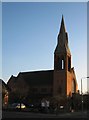
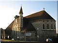
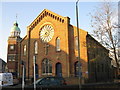
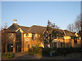
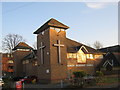
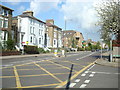
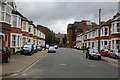
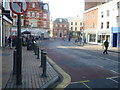
Photos of BR1 1RB
Area Information
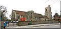
BR1 1RB is a compact residential postcode in the London Borough of Bromley, home to 1,451 people spread across 162 square metres. This area, part of the historic Bromley Town Ward, reflects the town’s evolution from a medieval village to a suburban hub. With a population density of nearly 9 million per square kilometre, the area is densely populated yet retains a small-town feel. Daily life here is shaped by proximity to Bromley’s historic market, rail links, and modern amenities. The postcode sits within a region that once thrived as a market town, its growth spurred by the 19th-century railway. Today, residents benefit from a mix of traditional and contemporary living, with easy access to transport, retail, and services. The area’s compact size means communities are tightly knit, and its history as a commuter destination continues to influence its character, blending suburban convenience with historical roots.
- Area Type
- Postcode
- Area Size
- 162 m²
- Population
- Not available
- Population Density
- Not available
BR1 1RB is a largely owner-occupied area, with 69% of homes owned by residents rather than rented. The accommodation type is predominantly houses, which is unusual for a postcode of this size but aligns with Bromley’s historical development as a suburban market town. This suggests a focus on single-family homes, which may appeal to families seeking space and privacy. The limited area size means the housing stock is constrained, potentially leading to competition for properties. Buyers should consider the small footprint of the postcode and its proximity to transport links, which may influence property values. The lack of flats or apartments indicates a market skewed toward traditional homeownership, with homes likely designed for long-term occupancy rather than short-term rental.
House Prices in BR1 1RB
No properties found in this postcode.
Energy Efficiency in BR1 1RB
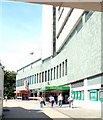
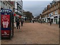
BR1 1RB offers a range of amenities within practical reach, enhancing daily life for residents. Nearby retail options include Sainsburys Bromley, Lidl Bromley, and M&S Bromley, ensuring access to essential shopping. The area’s transport network connects to Bromley North Station and several tram stops, facilitating easy travel to nearby towns and London. While no parks or leisure facilities are explicitly listed in the data, the proximity to Bromley’s historic market and surrounding suburbs suggests a blend of urban convenience and suburban amenities. The presence of multiple airports and ferry piers, though not in the immediate vicinity, indicates the area’s broader connectivity. This mix of retail, transport, and historical context creates a lifestyle that balances practicality with the legacy of a former market town.
Amenities
Schools
Near BR1 1RB are two distinct educational institutions: Ashgrove School Ltd, an independent school, and Education and Youth Services Ltd, a special school. The presence of an independent school suggests a demand for fee-paying education, while the special school caters to students with specific needs. This mix offers families options depending on their priorities, whether seeking private education or support services. However, no Ofsted ratings or academic performance data are available for these schools. The lack of state schools in the immediate vicinity may influence decisions for families requiring free or maintained education. Overall, the area provides a range of educational provisions, though prospective parents should investigate further to align with their child’s requirements.
| Rank | School | Type | Entry gender | Ages |
|---|
Explore more schools in this area
Go to Schools tabDemographics
The population of BR1 1RB has a median age of 47, with the majority aged between 30 and 64. This suggests a mature, established community with a strong presence of middle-aged residents. Home ownership stands at 69%, indicating a stable housing market with many long-term residents. The area is predominantly composed of houses, reflecting a preference for family-oriented living. The predominant ethnic group is White, though no specific data on diversity or deprivation is provided. The high population density of nearly 9 million per square kilometre implies a tightly packed residential environment, which may influence the pace of life and community interactions. This demographic profile suggests a settled, middle-aged population with a focus on home ownership and family-centric living.
Household Size
Accommodation Type
Tenure
Ethnic Group
Religion
Household Composition
Age
Household Deprivation
NS-SEC
Explore more demographic insights in this area
Go to Demographics tabPlanning
Planning Constraints
- Flood RiskPremium
- Ramsar Wetland SitesPremium
- Area of Outstanding Natural BeautyPremium
- Protected Nature ReservePremium
- Protected WoodlandPremium