Area Overview for SS15 5DT
Photos of SS15 5DT

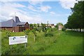
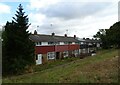
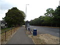

26 photos from this area
Area Information
Key information about the SS15 5DT including its size, population, and administrative classification.
- Area Type
- Postcode
- Area Size
- 6093 m²
- Population
- 1763
- Population Density
- 10034 people/km²
House Prices in SS15 5DT
21
Properties
£140,341
Average Sold Price
£69,500
Lowest Price
£191,000
Highest Price
Showing 21 properties
| Address | Type | Beds | Baths | Last Sale Price | Last Sale Date | |
|---|---|---|---|---|---|---|
| 294 Falstones, Basildon, SS15 5DT | house | - | - | £126,416 | Mar 2019 | |
| 312 Falstones, Basildon, SS15 5DT | Terraced | 4 | - | £176,000 | Oct 2014 | |
| 318 Falstones, Basildon, SS15 5DT | Flat | - | - | £69,500 | Mar 2013 | |
| 310 Falstones, Basildon, SS15 5DT | house | 4 | - | £191,000 | Nov 2012 | |
| 298 Falstones, Basildon, SS15 5DT | Terraced | 3 | - | £165,473 | Feb 2008 | |
| 306 Falstones, Basildon, SS15 5DT | Terraced | - | - | £164,000 | Jan 2007 | |
| 292 Falstones, Basildon, SS15 5DT | Terraced | - | - | £90,000 | Mar 2002 | |
| 284 Falstones, Basildon, SS15 5DT | Detached | - | - | - | - | |
| 286 Falstones, Basildon, SS15 5DT | Detached | - | - | - | - | |
| 308 Falstones, Basildon, SS15 5DT | Terraced | - | - | - | - |
Page 1 of 3
Energy Efficiency in SS15 5DT
Amenities
Schools
| Rank | School | Type | Entry gender | Ages |
|---|
Explore more schools in this area
Go to Schools tabDemographics
Household Size
Family (3-5 people)
most common
Accommodation Type
Houses
most common
Tenure
20
majority
Ethnic Group
White
most common
Religion
N/A
most common
Household Composition
N/A
most common
Age
22
median
Adults (30-64 years)
most common
Household Deprivation
N/A
with no deprivation
NS-SEC
16
in Lower managerial occupations
Explore more demographic insights in this area
Go to Demographics tabPlanning
Planning Constraints
- Flood RiskPremium
- Ramsar Wetland SitesPremium
- Area of Outstanding Natural BeautyPremium
- Protected Nature ReservePremium
- Protected WoodlandPremium