Area Overview for SS15 5DP
Photos of SS15 5DP

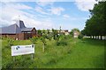
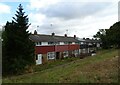
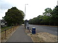

26 photos from this area
Area Information
Key information about the SS15 5DP including its size, population, and administrative classification.
- Area Type
- Postcode
- Area Size
- 2.0 hectares
- Population
- 1592
- Population Density
- 7293 people/km²
House Prices in SS15 5DP
23
Properties
£232,685
Average Sold Price
£29,700
Lowest Price
£435,000
Highest Price
Showing 23 properties
| Address | Type | Beds | Baths | Last Sale Price | Last Sale Date | |
|---|---|---|---|---|---|---|
| 143 Falstones, Basildon, SS15 5DP | Terraced | 3 | 1 | £343,000 | Feb 2025 | |
| 127 Falstones, Basildon, SS15 5DP | Terraced | 3 | 1 | £362,500 | Mar 2024 | |
| 157 Falstones, Basildon, SS15 5DP | Semi-detached | 4 | 3 | £435,000 | Nov 2023 | |
| 131 Falstones, Basildon, SS15 5DP | house | 3 | 1 | £330,000 | Sep 2023 | |
| 147 Falstones, Basildon, SS15 5DP | house | - | - | £287,000 | Apr 2022 | |
| 151 Falstones, Basildon, SS15 5DP | house | - | - | £270,000 | Mar 2022 | |
| 137 Falstones, Basildon, SS15 5DP | Terraced | 3 | - | £300,000 | Feb 2022 | |
| 153 Falstones, Basildon, SS15 5DP | Terraced | 3 | 1 | £280,000 | Jun 2021 | |
| 141 Falstones, Basildon, SS15 5DP | Terraced | 3 | 1 | £255,000 | Jun 2018 | |
| 177 Falstones, Basildon, SS15 5DP | house | - | - | £335,000 | Aug 2017 |
Page 1 of 3
Energy Efficiency in SS15 5DP
Amenities
Schools
| Rank | School | Type | Entry gender | Ages |
|---|
Explore more schools in this area
Go to Schools tabDemographics
Household Size
Family (3-5 people)
most common
Accommodation Type
Houses
most common
Tenure
68
majority
Ethnic Group
White
most common
Religion
N/A
most common
Household Composition
N/A
most common
Age
47
median
Adults (30-64 years)
most common
Household Deprivation
N/A
with no deprivation
NS-SEC
29
in Lower managerial occupations
Explore more demographic insights in this area
Go to Demographics tabPlanning
Planning Constraints
- Flood RiskPremium
- Ramsar Wetland SitesPremium
- Area of Outstanding Natural BeautyPremium
- Protected Nature ReservePremium
- Protected WoodlandPremium