Area Overview for SS15 4EN
Photos of SS15 4EN
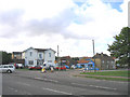
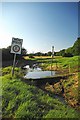
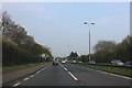
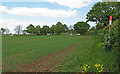
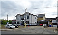
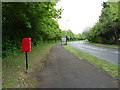
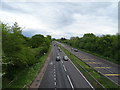
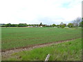
19 photos from this area
Area Information
Key information about the SS15 4EN including its size, population, and administrative classification.
- Area Type
- Postcode
- Area Size
- 1.9 hectares
- Population
- 1704
- Population Density
- 918 people/km²
House Prices in SS15 4EN
39
Properties
£280,179
Average Sold Price
£75,500
Lowest Price
£487,500
Highest Price
Showing 39 properties
| Address | Type | Beds | Baths | Last Sale Price | Last Sale Date | |
|---|---|---|---|---|---|---|
| 54 Wash Road, Laindon, SS15 4EN | Bungalow | - | - | £400,000 | Jan 2025 | |
| The Elms, 11 Wash Road, Laindon, SS15 4EN | Bungalow | 3 | 2 | £487,500 | Jan 2024 | |
| Medina, 23 Wash Road, Laindon, SS15 4EN | house | - | - | £425,000 | Oct 2021 | |
| Fallowfield, 25 Wash Road, Laindon, SS15 4EN | Semi-detached | 3 | - | £280,000 | Feb 2014 | |
| 60 Wash Road, Laindon, SS15 4EN | Bungalow | - | - | £210,000 | Aug 2013 | |
| 46 Wash Road, Laindon, SS15 4EN | house | 5 | - | £320,000 | Aug 2012 | |
| 50 Wash Road, Laindon, SS15 4EN | Bungalow | - | - | £210,000 | Mar 2010 | |
| Mundles Farm, 35 Wash Road, Laindon, SS15 4EN | house | 4 | 2 | £360,000 | Oct 2009 | |
| 56 Wash Road, Laindon, SS15 4EN | Bungalow | 2 | - | £247,000 | Oct 2007 | |
| 33 Wash Road, Laindon, SS15 4EN | Semi-detached | - | - | £222,500 | Feb 2007 |
Page 1 of 4
Energy Efficiency in SS15 4EN
Amenities
Schools
| Rank | School | Type | Entry gender | Ages |
|---|
Explore more schools in this area
Go to Schools tabDemographics
Household Size
Family (3-5 people)
most common
Accommodation Type
Houses
most common
Tenure
76
majority
Ethnic Group
White
most common
Religion
N/A
most common
Household Composition
N/A
most common
Age
47
median
Adults (30-64 years)
most common
Household Deprivation
N/A
with no deprivation
NS-SEC
34
in Lower managerial occupations
Explore more demographic insights in this area
Go to Demographics tabPlanning
Planning Constraints
- Flood RiskPremium
- Ramsar Wetland SitesPremium
- Area of Outstanding Natural BeautyPremium
- Protected Nature ReservePremium
- Protected WoodlandPremium