Area Overview for SG3 6NS
Photos of SG3 6NS
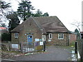
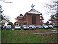
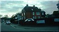
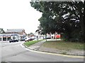
24 photos from this area
Area Information
Key information about the SG3 6NS including its size, population, and administrative classification.
- Area Type
- Postcode
- Area Size
- 6.9 hectares
- Population
- 1850
- Population Density
- 1793 people/km²
House Prices in SG3 6NS
24
Properties
£645,731
Average Sold Price
£246,000
Lowest Price
£1,070,000
Highest Price
Showing 24 properties
| Address | Type | Beds | Baths | Last Sale Price | Last Sale Date | |
|---|---|---|---|---|---|---|
| 2 Oakfields Road, Knebworth, SG3 6NS | Detached | 4 | 4 | £931,000 | Oct 2025 | |
| 15 Oakfields Road, Knebworth, SG3 6NS | house | - | - | £1,070,000 | Dec 2020 | |
| 5 Oakfields Road, Knebworth, SG3 6NS | house | - | - | £800,000 | Nov 2019 | |
| 19 Oakfields Road, Knebworth, SG3 6NS | house | - | - | £596,000 | Jan 2015 | |
| 20 Oakfields Road, Knebworth, SG3 6NS | Detached | 5 | 3 | £757,500 | Feb 2014 | |
| 6 Oakfields Road, Knebworth, SG3 6NS | house | - | - | £620,500 | Aug 2012 | |
| 1 Oakfields Road, Knebworth, SG3 6NS | Detached | 4 | 2 | £735,000 | Feb 2010 | |
| 17 Oakfields Road, Knebworth, SG3 6NS | Detached | - | - | £720,000 | Dec 2007 | |
| 16 Oakfields Road, Knebworth, SG3 6NS | Detached | - | - | £560,000 | Nov 2006 | |
| 13 Oakfields Road, Knebworth, SG3 6NS | Detached | - | - | £540,000 | Aug 2005 |
Page 1 of 3
Energy Efficiency in SG3 6NS
Amenities
Schools
| Rank | School | Type | Entry gender | Ages |
|---|
Explore more schools in this area
Go to Schools tabDemographics
Household Size
Two person
most common
Accommodation Type
Houses
most common
Tenure
70
majority
Ethnic Group
White
most common
Religion
N/A
most common
Household Composition
N/A
most common
Age
47
median
Adults (30-64 years)
most common
Household Deprivation
N/A
with no deprivation
NS-SEC
53
in Lower managerial occupations
Explore more demographic insights in this area
Go to Demographics tabPlanning
Planning Constraints
- Flood RiskPremium
- Ramsar Wetland SitesPremium
- Area of Outstanding Natural BeautyPremium
- Protected Nature ReservePremium
- Protected WoodlandPremium