Area Overview for SG3 6AW
Photos of SG3 6AW
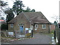
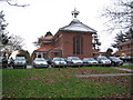
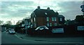
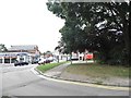
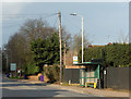
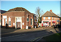
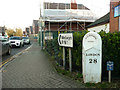
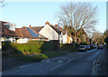
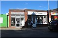
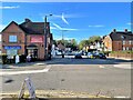
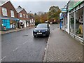
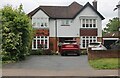
24 photos from this area
Area Information
Key information about the SG3 6AW including its size, population, and administrative classification.
- Area Type
- Postcode
- Area Size
- 2.4 hectares
- Population
- 1850
- Population Density
- 1793 people/km²
House Prices in SG3 6AW
15
Properties
£731,500
Average Sold Price
£310,000
Lowest Price
£946,000
Highest Price
Showing 15 properties
| Address | Type | Beds | Baths | Last Sale Price | Last Sale Date | |
|---|---|---|---|---|---|---|
| 12 Stevenage Road, Knebworth, SG3 6AW | Detached | 4 | 3 | £920,000 | Aug 2025 | |
| 14 Stevenage Road, Knebworth, SG3 6AW | Detached | 4 | 2 | £946,000 | Nov 2024 | |
| 22 Stevenage Road, Knebworth, SG3 6AW | house | - | - | £875,000 | Dec 2021 | |
| 18 Stevenage Road, Knebworth, SG3 6AW | house | - | - | £820,000 | Jun 2020 | |
| 26A Stevenage Road, Knebworth, SG3 6AW | Detached | 5 | 1 | £880,000 | May 2019 | |
| 2 Stevenage Road, Knebworth, SG3 6AW | house | - | - | £810,000 | Nov 2016 | |
| 4 Stevenage Road, Knebworth, SG3 6AW | Retail | 4 | 2 | £905,000 | Aug 2016 | |
| 10 Stevenage Road, Knebworth, SG3 6AW | Terraced | - | - | £399,995 | Jul 2007 | |
| 6 Stevenage Road, Knebworth, SG3 6AW | house | - | - | £493,500 | Oct 2006 | |
| 20 Stevenage Road, Knebworth, SG3 6AW | Terraced | - | - | £687,000 | May 2005 |
Page 1 of 2
Energy Efficiency in SG3 6AW
Amenities
Schools
| Rank | School | Type | Entry gender | Ages |
|---|
Explore more schools in this area
Go to Schools tabDemographics
Household Size
Two person
most common
Accommodation Type
Houses
most common
Tenure
70
majority
Ethnic Group
White
most common
Religion
N/A
most common
Household Composition
N/A
most common
Age
47
median
Adults (30-64 years)
most common
Household Deprivation
N/A
with no deprivation
NS-SEC
53
in Lower managerial occupations
Explore more demographic insights in this area
Go to Demographics tabPlanning
Planning Constraints
- Flood RiskPremium
- Ramsar Wetland SitesPremium
- Area of Outstanding Natural BeautyPremium
- Protected Nature ReservePremium
- Protected WoodlandPremium