Area Overview for SG17 5ZG
Photos of SG17 5ZG
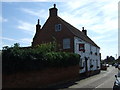
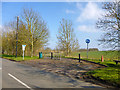
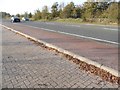
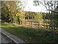
28 photos from this area
Area Information
Key information about the SG17 5ZG including its size, population, and administrative classification.
- Area Type
- Postcode
- Area Size
- 1.3 hectares
- Population
- 2112
- Population Density
- 1320 people/km²
House Prices in SG17 5ZG
17
Properties
£483,161
Average Sold Price
£318,795
Lowest Price
£815,000
Highest Price
Showing 17 properties
| Address | Type | Beds | Baths | Last Sale Price | Last Sale Date | |
|---|---|---|---|---|---|---|
| 14 Faraday Corner, Shefford, SG17 5ZG | house | - | - | £405,000 | Nov 2024 | |
| 1 Faraday Corner, Shefford, SG17 5ZG | house | - | - | £495,000 | Sep 2023 | |
| 2 Faraday Corner, Shefford, SG17 5ZG | Semi-detached | 3 | 2 | £422,000 | Aug 2023 | |
| 22 Faraday Corner, Shefford, SG17 5ZG | Detached | 4 | 2 | £500,000 | Aug 2023 | |
| 9 Faraday Corner, Shefford, SG17 5ZG | house | - | - | £815,000 | Dec 2022 | |
| 4 Faraday Corner, Shefford, SG17 5ZG | house | - | - | £368,000 | Nov 2022 | |
| 8 Faraday Corner, Shefford, SG17 5ZG | Terraced | 3 | 2 | £319,995 | Jun 2020 | |
| 11 Faraday Corner, Shefford, SG17 5ZG | Detached | 5 | 3 | £624,995 | Jun 2020 | |
| 16 Faraday Corner, Shefford, SG17 5ZG | house | - | - | £674,995 | Apr 2020 | |
| 5 Faraday Corner, Shefford, SG17 5ZG | Detached | 5 | 3 | £624,995 | Jan 2020 |
Page 1 of 2
Energy Efficiency in SG17 5ZG
Amenities
Schools
| Rank | School | Type | Entry gender | Ages |
|---|
Explore more schools in this area
Go to Schools tabDemographics
Household Size
Family (3-5 people)
most common
Accommodation Type
Houses
most common
Tenure
79
majority
Ethnic Group
White
most common
Religion
N/A
most common
Household Composition
N/A
most common
Age
47
median
Adults (30-64 years)
most common
Household Deprivation
N/A
with no deprivation
NS-SEC
48
in Lower managerial occupations
Explore more demographic insights in this area
Go to Demographics tabPlanning
Planning Constraints
- Flood RiskPremium
- Ramsar Wetland SitesPremium
- Area of Outstanding Natural BeautyPremium
- Protected Nature ReservePremium
- Protected WoodlandPremium