Area Overview for SG17 5BN
Photos of SG17 5BN
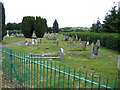
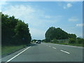
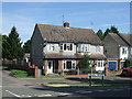
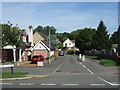
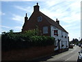
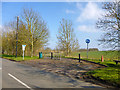
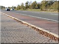
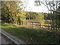
28 photos from this area
Area Information
Key information about the SG17 5BN including its size, population, and administrative classification.
- Area Type
- Postcode
- Area Size
- 37.5 hectares
- Population
- 2112
- Population Density
- 1320 people/km²
House Prices in SG17 5BN
47
Properties
£357,948
Average Sold Price
£39,000
Lowest Price
£725,000
Highest Price
Showing 47 properties
| Address | Type | Beds | Baths | Last Sale Price | Last Sale Date | |
|---|---|---|---|---|---|---|
| 22 Greenway, Campton, SG17 5BN | Semi-detached | 2 | 2 | £380,000 | May 2024 | |
| 20 Greenway, Campton, SG17 5BN | house | 4 | 3 | £325,000 | Sep 2023 | |
| 2 Greenway, Campton, SG17 5BN | house | - | - | £725,000 | Nov 2022 | |
| 3A Greenway, Campton, SG17 5BN | Detached | 2 | 1 | £370,000 | Jul 2022 | |
| 39 Greenway, Campton, SG17 5BN | Semi-detached | 5 | - | £675,000 | Jun 2022 | |
| Church Farm Barn, 4B Greenway, Campton, SG17 5BN | Semi-detached | 4 | 2 | £670,000 | Jun 2021 | |
| 34 Greenway, Campton, SG17 5BN | Bungalow | 3 | 2 | £550,000 | Mar 2021 | |
| 35 Greenway, Campton, SG17 5BN | house | - | - | £415,000 | May 2020 | |
| Gateside, 38 Greenway, Campton, SG17 5BN | house | - | - | £530,000 | Sep 2019 | |
| Church Farm, 4 Greenway, Campton, SG17 5BN | Detached | 3 | 2 | £405,000 | Aug 2019 |
Page 1 of 5
Energy Efficiency in SG17 5BN
Amenities
Schools
| Rank | School | Type | Entry gender | Ages |
|---|
Explore more schools in this area
Go to Schools tabDemographics
Household Size
Family (3-5 people)
most common
Accommodation Type
Houses
most common
Tenure
79
majority
Ethnic Group
White
most common
Religion
N/A
most common
Household Composition
N/A
most common
Age
47
median
Adults (30-64 years)
most common
Household Deprivation
N/A
with no deprivation
NS-SEC
48
in Lower managerial occupations
Explore more demographic insights in this area
Go to Demographics tabPlanning
Planning Constraints
- Flood RiskPremium
- Ramsar Wetland SitesPremium
- Area of Outstanding Natural BeautyPremium
- Protected Nature ReservePremium
- Protected WoodlandPremium